A Remote Sensing Grading Method for Large-scale Crop Growth Condition
A crop and large-scale technology, applied in the field of remote sensing image processing, can solve problems such as irrationality, accuracy problems, and difficulty in ensuring accuracy, and achieve the effects of improving objectivity, reducing monitoring costs, and avoiding phenological changes
- Summary
- Abstract
- Description
- Claims
- Application Information
AI Technical Summary
Problems solved by technology
Method used
Image
Examples
Embodiment Construction
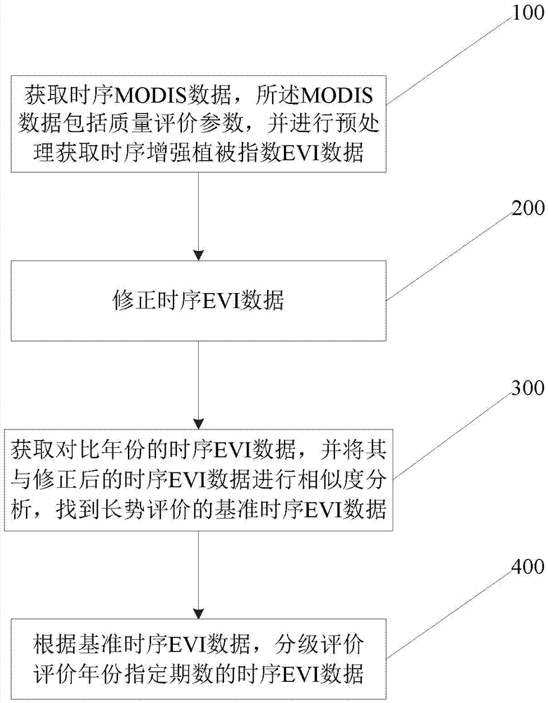
[0051] Such as figure 1 Shown, the remote sensing rating method of the present invention's large-scale crop growth condition comprises:
[0052] Step 100: Obtain time-series MODIS data, the MODIS data includes quality evaluation parameters, and perform preprocessing to obtain time-series Enhanced Vegetation Index (EVI) data.
[0053]Among them, the present invention mainly adopts the data of a Moderate-resolution Imaging Spectral Imager (MODIS for short) as basic data.
[0054] The present invention uses the enhanced vegetation index (Enhanced Vegetation Index, EVI) as the growth assessment basis. The time-series MODIS data are data obtained from surface albedo (MOD09) or vegetation index (MOD13).
[0055] When the sequential MODIS data is obtained from the surface reflectance, the calculation formula of EVI is divided into two types:
[0056] Normal area, enhanced vegetation index
[0057] Cloud, Snow Covered Areas: Enhanced Vegetation Index
[0058] Among them, G, L...
PUM
 Abstract
Description
Claims
Application Information
 - R&D
- Intellectual Property
- Life Sciences
- Materials
- Tech Scout
- Unparalleled Data Quality
- Higher Quality Content
- 60% Fewer Hallucinations
Browse by: Latest US Patents, China's latest patents, Technical Efficacy Thesaurus, Application Domain, Technology Topic, Popular Technical Reports.
© 2025 PatSnap. All rights reserved.Legal|Privacy policy|Modern Slavery Act Transparency Statement|Sitemap|About US| Contact US: help@patsnap.com


