Method for positioning nodes of underwater sensor network
A technology of underwater sensors and sensor nodes, applied in network topology, electrical components, wireless communication, etc., can solve problems such as inability to locate, reduce positioning accuracy, and fail to meet actual application requirements
- Summary
- Abstract
- Description
- Claims
- Application Information
AI Technical Summary
Problems solved by technology
Method used
Image
Examples
Embodiment Construction
[0034] The present invention will be further described below in conjunction with the drawings and embodiments.
[0035] 1. The establishment of spatial rectangular coordinate system
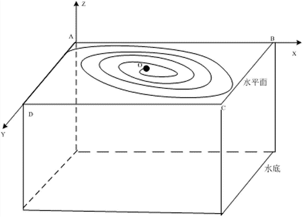
[0036] Select the center of the water surface in the area to be positioned to establish a spatial rectangular coordinate system. Such as figure 1 As shown, the principle diagram for establishing a spatial rectangular coordinate system is given. Assuming that the underwater positioning area is a regular cube (M*N*H), where M, N, and H are the length, width, and height of the cube respectively, then The water surface of the positioning area is a regular rectangular area (M*N), A, B, C, and D are the vertices of the rectangle. Choose one of the nodes A as the origin. The X axis is parallel to one side AB of the rectangle, and the Y axis is parallel to the rectangle. On the other side BC, the horizontal plane is the XOY plane to establish a spatial rectangular coordinate system, where the z-axis represen...
PUM
 Abstract
Description
Claims
Application Information
 - R&D
- Intellectual Property
- Life Sciences
- Materials
- Tech Scout
- Unparalleled Data Quality
- Higher Quality Content
- 60% Fewer Hallucinations
Browse by: Latest US Patents, China's latest patents, Technical Efficacy Thesaurus, Application Domain, Technology Topic, Popular Technical Reports.
© 2025 PatSnap. All rights reserved.Legal|Privacy policy|Modern Slavery Act Transparency Statement|Sitemap|About US| Contact US: help@patsnap.com


