System and method for correcting global positioning system (GPS) height data of national marine electronics association (NMEA) information

A data correction and GPS signal technology, which is applied in the field of GPS height data correction system of NMEA information, can solve the problems of inaccurate navigation and low accuracy of GPS height data, and achieve the effect of accurate positioning and navigation

Inactive Publication Date: 2012-05-09
HUANDA COMPUTER (SHANGHAI) CO LTD
View PDF5 Cites 14 Cited by
  • Summary
  • Abstract
  • Description
  • Claims
  • Application Information

AI Technical Summary

Problems solved by technology

[0006] The purpose of the present invention is to provide a GPS altitude data correction system and method for NMEA information, thereby solving the problem of inaccurate navigation caused by the low accuracy of GPS altitude data

Method used


Image

  • System and method for correcting global positioning system (GPS) height data of national marine electronics association (NMEA) information
  • System and method for correcting global positioning system (GPS) height data of national marine electronics association (NMEA) information
  • System and method for correcting global positioning system (GPS) height data of national marine electronics association (NMEA) information

Examples


Embodiment Construction

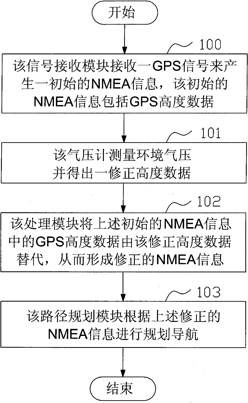
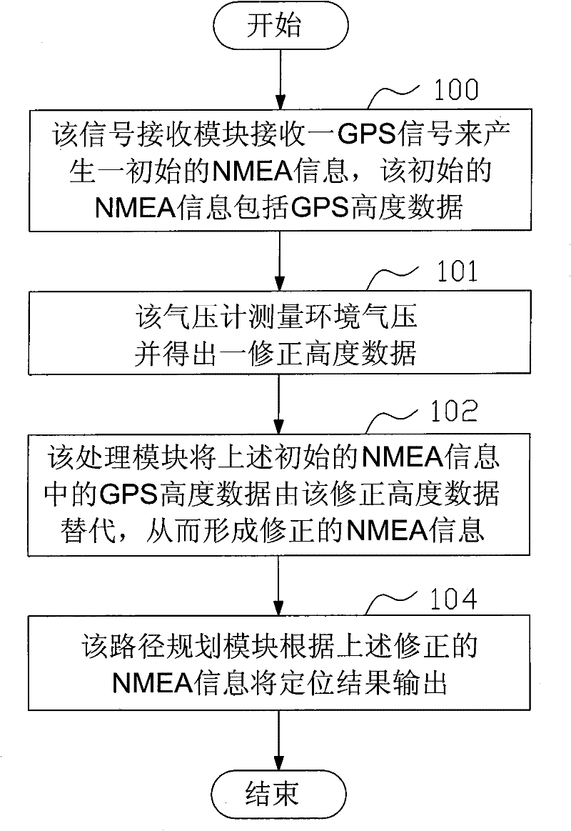
[0024] see figure 1 , figure 1 Shown is a block module diagram of a preferred embodiment of the GPS altitude data correction system for NMEA information of the present invention.

[0025] For reaching above-mentioned purpose, the GPS altitude data correction system of the NMEA information provided by the present invention, this system is based on a navigation / positioning device 10, and this system comprises:

[0026] A signal receiving module 1, used to receive a GPS signal to generate an initial NMEA information, the initial NMEA information includes GPS height data;

[0027] A barometer 2, used to measure ambient air pressure and obtain a corrected altitude data based on the ambient air pressure;

[0028] A processing module 3, which is connected with the above-mentioned signal receiving module and the above-mentioned barometer, is used to replace the GPS altitude data in the above-mentioned initial NMEA information with the corrected altitude data, so as to form the corre...


PUM


Abstract

The invention discloses a system and method for correcting global positioning system (GPS) height data of national marine electronics association (NMEA) information. The system is based on a navigation / positioning device, and comprises a signal receiving module, a barometer and a processing module. The method comprises the following steps: receiving a GPS signal by the signal receiving module to generate initial NMEA information; the initial NMEA information comprises the GPS height data; the barometer is used for measuring ambient pressure and obtaining corrected height data; and the processing module is used for replacing the GPS height data in the initial NMEA information by the corrected height data, thereby, corrected NMEA information is formed. By utilizing the system and method for correcting the GPS height data of the NMEA information, as the more accurate corrected height data obtained by the barometer is adopted to replace the GPS height data with lower accuracy to form the corrected NMEA information with higher accuracy for positioning navigation, the positioning navigation is more accurate.

Description

【Technical field】 [0001] The invention provides GPS height data of NMEA information, especially a system and method for correcting GPS height data of NMEA information. 【Background technique】 [0002] With the development of positioning and navigation technology, various positioning and navigation systems have been widely used in people's daily life. Taking GPS (Global Position System) as an example, it has developed from the initial vehicle positioning and navigation to Present personal positioning navigation, the appearance and development of GPS system, have brought great convenience for people's daily life. [0003] NMEA is the abbreviation of "National Marine Electronics Association" (International Marine Electronics Association), and it is also an industry association for data transmission standards. Here, it should actually be NMEA 0183. It is a set of standard information that defines the output of the receiver. There are several different formats, each of which is a...

Claims


Application Information

Patent Timeline
IPC IPC(8): G01S19/40G01C21/34
Inventor 钟云洋
Owner HUANDA COMPUTER (SHANGHAI) CO LTD
Why Eureka
Try Eureka