Improved NCS (Nonlinear Chirp Scaling) imaging algorithm suitable for geosynchronous orbit (GEO) SAR (Synthetic Aperture Radar)
A geosynchronous orbit and imaging technology, applied in the direction of using re-radiation, reflection/re-radiation of radio waves, measurement devices, etc., can solve the problems of long equivalent linear model, failure, and difficulty in directly applying GEOSAR.
- Summary
- Abstract
- Description
- Claims
- Application Information
AI Technical Summary
Problems solved by technology
Method used
Image
Examples
Embodiment
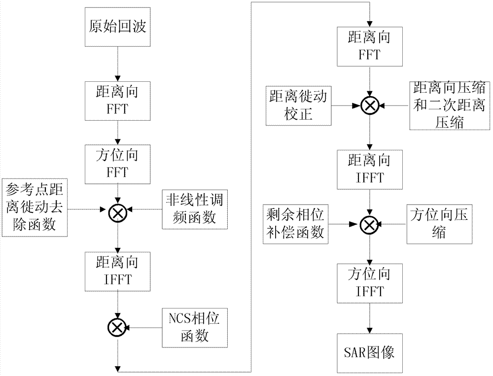
[0100] The radar flies at a certain speed in a geosynchronous orbit, transmits chirp signals to the ground, and receives echoes from the ground. Perform imaging processing on the obtained echoes, and propose an improved NCS algorithm suitable for GEO SAR. The specific steps are as follows: figure 1 shown, including:
[0101] 1) The target echo received by the radar
[0102] Radar transmits a carrier frequency f c linear frequency modulation signal. After demodulating the received echo, we can get
[0103] s ( t r , t a ) = u r ( t r - 2 · R n c ) · ...
PUM
 Abstract
Description
Claims
Application Information
 - R&D
- Intellectual Property
- Life Sciences
- Materials
- Tech Scout
- Unparalleled Data Quality
- Higher Quality Content
- 60% Fewer Hallucinations
Browse by: Latest US Patents, China's latest patents, Technical Efficacy Thesaurus, Application Domain, Technology Topic, Popular Technical Reports.
© 2025 PatSnap. All rights reserved.Legal|Privacy policy|Modern Slavery Act Transparency Statement|Sitemap|About US| Contact US: help@patsnap.com


