
Method for automatically stitching unmanned aerial vehicle remote sensing images based on flight control information

A flight control and automatic splicing technology, applied in image analysis, image data processing, computer parts and other directions, can solve the problem of not making full use of UAV remote sensing image flight control information, not taking into account the deflection deformation, and not suitable for UAVs. Remote sensing image stitching and other issues

Inactive Publication Date: 2010-12-15
REMOTE SENSING APPLIED INST CHINESE ACAD OF SCI
View PDF2 Cites 39 Cited by
  • Summary
  • Abstract
  • Description
  • Claims
  • Application Information

AI Technical Summary

Problems solved by technology

However, these studies are not aimed at the application of UAV remote sensing, but for ordinary photography. They did not make full use of the flight control information of UAV remote sensing images, and did not consider the deformation caused by factors such as flight deviation, so they are not suitable for UAV remote sensing. image stitching

Method used


Image

  • Method for automatically stitching unmanned aerial vehicle remote sensing images based on flight control information
  • Method for automatically stitching unmanned aerial vehicle remote sensing images based on flight control information
  • Method for automatically stitching unmanned aerial vehicle remote sensing images based on flight control information

Examples


Embodiment Construction

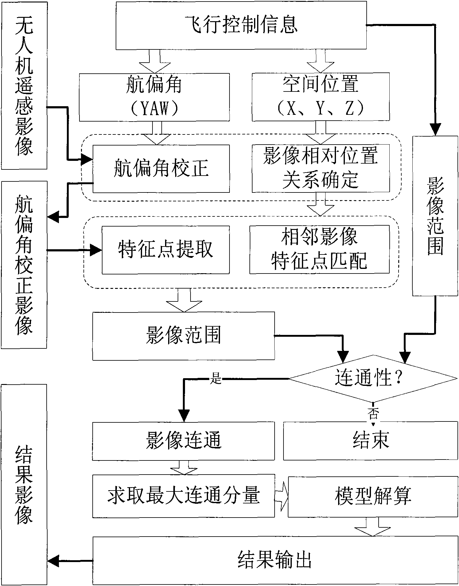
[0033] figure 1 It is a flow chart of an automatic stitching method of UAV remote sensing images based on flight control information. The present invention makes full use of the flight control information obtained by the UAV flight control system, performs image declination correction and adjacency relationship determination, and performs feature point extraction and matching on this basis, which makes the calculation amount from o(n 2 ) is reduced to O(n), and the matching accuracy is improved. Finally, the model calculation is performed, the coordinate transformation matrix is ​​determined, and the panoramic image is output. combine figure 1 , the specific implementation is described as follows:

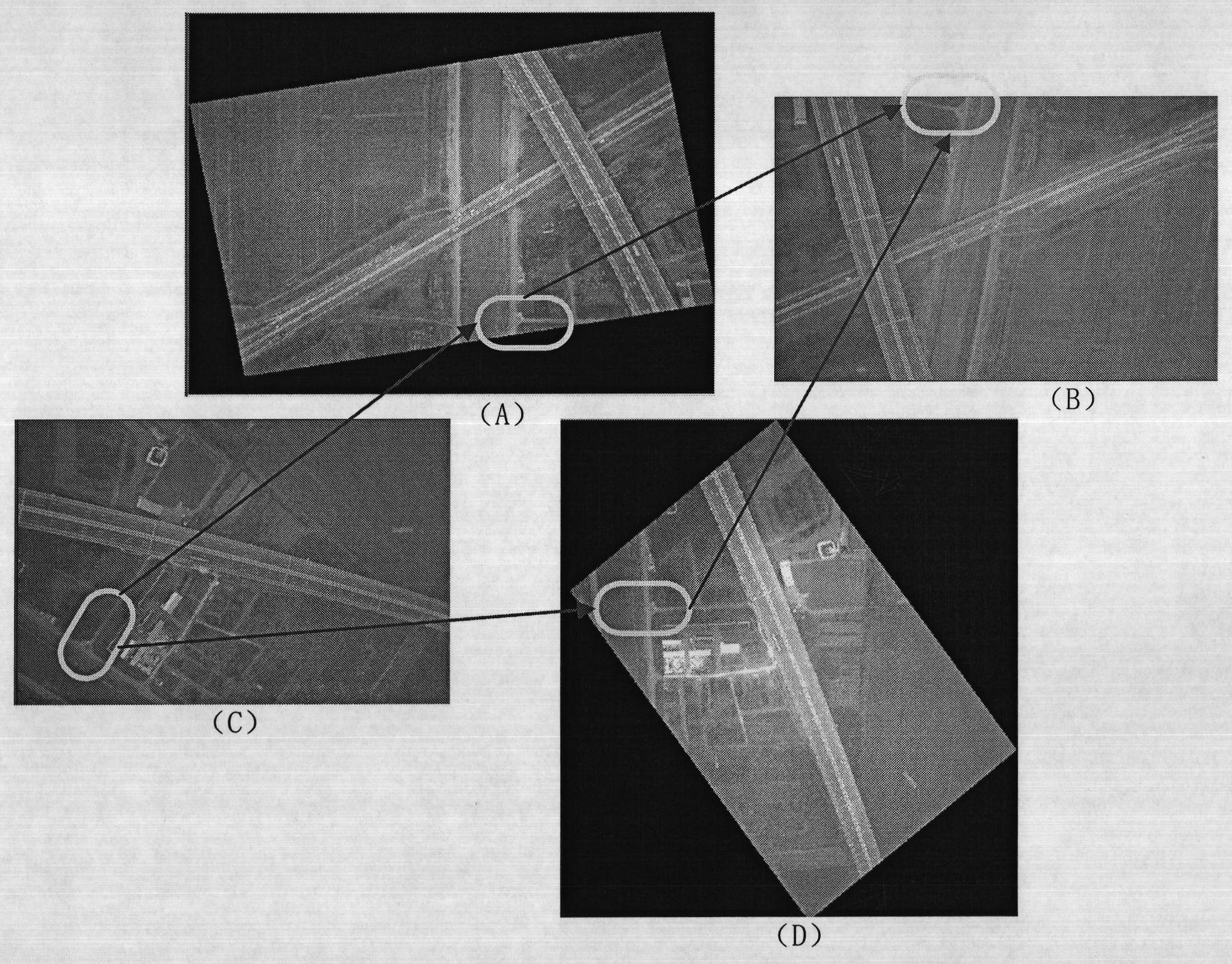
[0034] First, the geometric deformation is corrected according to the UAV's deflection angle. figure 2 It is a schematic diagram of the UAV remote sensing image heading correction. figure 2 (B) and figure 2 (C) There is a large overlapping area, but due to the opposite fligh...


PUM


Abstract

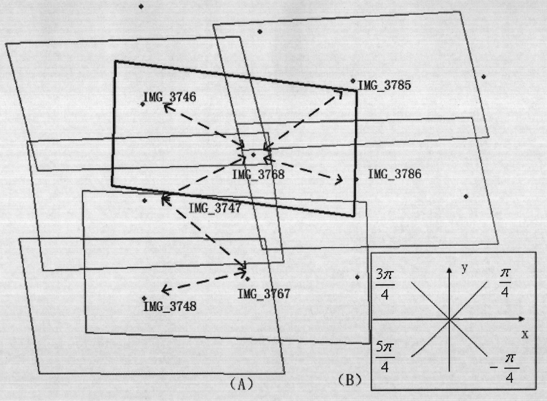
The invention provides a method for automatically stitching unmanned aerial vehicle remote sensing images based on flight control information, which in particular realizes automatic correction and stitching of the unmanned aerial vehicle remote sensing images according to attitude parameters acquired by a flight control system. The method comprises the following steps of: correcting aircraft yaws of the images and determining adjacency relation of the images according to the attitude parameters acquired by an unmanned aerial vehicle flight control system; extracting characteristic points from the corrected images, matching the characteristic points with those of adjacent images and extracting identical points; calculating a range of the output images according to an image calculating model, comparing the range with the range determined by the attitude parameters, and if the difference is within a tolerance range, considering that the number and the quality of the identical points between the adjacent images meet the stitching requirement and the images are connected; sequentially calculating connection relation among all images and solving the maximum connection component among the images; and determining a transformation parameter by performing model calculation according to the connection component and outputting a stitched image of a research region.

Description

technical field [0001] The invention relates to the automatic processing of remote sensing images of unmanned aerial vehicles, which specifically includes the automatic correction and splicing of the deflection angle of the remote sensing images of unmanned aerial vehicles according to the flight control information obtained by the flight control system of the unmanned aerial vehicles. The invention can be applied to real-time fast splicing of remote sensing images of unmanned aerial vehicles. Background technique [0002] Drone technology was originally used in the military field. After World War II, UAV technology has developed rapidly, mainly used for military reconnaissance and real-time monitoring in dangerous and harsh environments. Since the 1980s, UAVs have been increasingly widely used, and have been applied to the field of aerial photogrammetry. As an important supplementary means of satellite remote sensing, UAV has the ability to fly at low altitude under cloud...

Claims


Application Information

Patent Timeline
IPC IPC(8): G06T11/60G06T7/00G06K9/46
Inventor 吴炜朱志文骆剑承沈占锋郜丽静周亚男
Owner REMOTE SENSING APPLIED INST CHINESE ACAD OF SCI
Learn More