
Hand-hold traffic accident fast on-site coordinate machine

A traffic accident, surveying and mapping instrument technology, applied in the field of surveying and mapping instruments, can solve the problems of inability to describe the stopping posture of vehicles and pedestrians in detail, cannot meet the requirements of high-precision size measurement, and takes a long time in the image processing process to achieve light weight, fast processing and Effects of Transformation, Simplification of Functions and Structure

Inactive Publication Date: 2011-08-31
SHANGHAI JIAOTONG UNIV
View PDF2 Cites 0 Cited by
  • Summary
  • Abstract
  • Description
  • Claims
  • Application Information

AI Technical Summary

Problems solved by technology

[0004] After searching the existing technical literature, it is found that the Chinese invention patent (application number 95116541.0) has announced a system for computer-aided surveying and mapping traffic accident scenes, which integrates supporting equipment, software development, close-range photogrammetry technology and mathematical algorithms. Set pars and marker balls on site, use cameras and video cameras to shoot around the site, turn them into digital image files through scanners and sound blasters, and obtain marker point plane coordinate data files and markers by auxiliary measurement programs, three-dimensional model recovery programs and drawing programs Point the three-dimensional coordinate data file and draw the plane and section diagram of the accident scene. The image processing process of the system takes a long time and the operation is complicated, which is not suitable for on-site operation. As a result, the scene map cannot be generated in time at the traffic accident scene, which brings inconvenience to the accident handling. The generated on-site graphics cannot meet the industry standards for on-site drawing of the traffic police department
U.S. Invention Patent (Application No. 20040150816) photogrammetry dimension analysis system provides two-point positioning through the control unit and a standard point, so as to define a datum plane as the photogrammetry datum plane, using a square as the size datum to determine the measured figure Size ratio, the system only analyzes the size information of the traffic accident scene, and cannot describe the stopping posture of vehicles and pedestrians in detail. At the same time, the use of squares as the size reference cannot meet some high-precision size measurement requirements

Method used


Image

  • Hand-hold traffic accident fast on-site coordinate machine
  • Hand-hold traffic accident fast on-site coordinate machine
  • Hand-hold traffic accident fast on-site coordinate machine

Examples


Embodiment Construction

[0036] The embodiments of the present invention are described in detail below in conjunction with the accompanying drawings: this embodiment is implemented on the premise of the technical solution of the present invention, and detailed implementation methods and specific operating procedures are provided, but the protection scope of the present invention is not limited to the following the described embodiment.

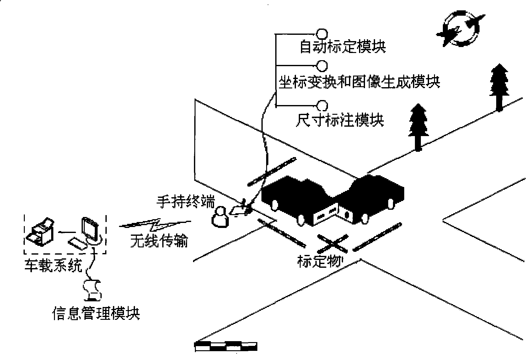
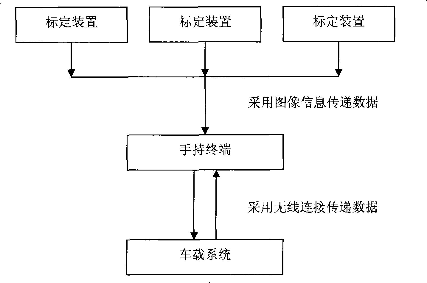
[0037] Such as figure 1 As shown, the composition and structure diagram of the rapid surveying and mapping instrument at the traffic accident scene in this embodiment includes: a calibration device, a handheld terminal and an embedded automatic calibration module, a coordinate transformation and image generation module, a dimensioning module, an on-board system and an information management module.

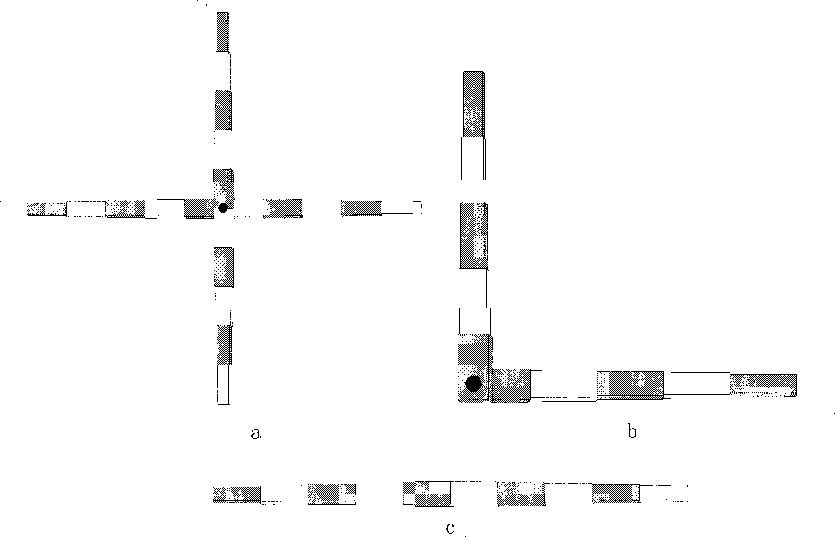
[0038] First of all, the calibration device placed at the traffic accident scene generally only needs to place the main calibration object, and for some complex scenes, i...


PUM


Abstract

The invention relates to a hand-held traffic accident site fast surveying instrument which includes a calibration device, a hand-held terminal, an automatic calibration module, a coordinate exchange and image generating module, a size dimension module, a vehicle system and an information management module; wherein, the calibration device is sued for carrying out calibration on the measuring size and location of shooting; the hand-held terminal integrates a digital vidicon and a flat computer in a whole; a touch screen and an induction pen are adopted as input tools; the vehicle system and thehand-held terminal are realized to be wirelessly connected by the Bluetooth technology; the operation on the vehicle system can be controlled, a site graph and a site survey note can be printed as well as organization and management can be carried out on the site collected data from the hand-held terminal. The automatic calibration module, the coordinate exchange and image generating module and the size dimension module are arranged on the hand-held terminal; the size dimension module is arranged on the hand-held terminal; the information management module is arranged on the vehicle system for providing support for processing the accident site image and managing the site collected data. The accident site fast surveying instrument of the invention has the advantages of short period, high precision and high reliability.

Description

technical field [0001] The invention relates to a surveying and mapping instrument in the technical field of digital measurement, in particular to a hand-held rapid surveying and mapping instrument for traffic accidents. Background technique [0002] At present, most traffic accident site surveys at home and abroad mainly rely on traditional methods such as human eye judgment, hand touch, tape measurement, and manual drawing, which are prone to missed measurements, wrong measurements, missing pictures, and wrong pictures. The method is also limited by the environment, climate and time. If a traffic accident occurs in a deep ditch or encounters rain and snow, dense fog and night, it will bring great difficulties to the site survey. In addition, with the highway, elevated The development of highways and bridges has put forward higher requirements for the handling of traffic accidents, that is, the maximum amount of accident scene information should be collected in the shortest...

Claims


Application Information

Patent Timeline
Patent Type & Authority Patents(China)
IPC IPC(8): G01C11/00
Inventor 金先龙柴象海张晓云
Owner SHANGHAI JIAOTONG UNIV
Learn More