
Aircraft navigation system

a navigation system and aircraft technology, applied in the field of aircraft, can solve the problems of difficult use of the planned route display, and the inability to display the planned route as desired by the operator managing the unmanned aerial vehicl

Active Publication Date: 2014-07-15
THE BOEING CO
View PDF12 Cites 11 Cited by
  • Summary
  • Abstract
  • Description
  • Claims
  • Application Information

AI Technical Summary

Problems solved by technology

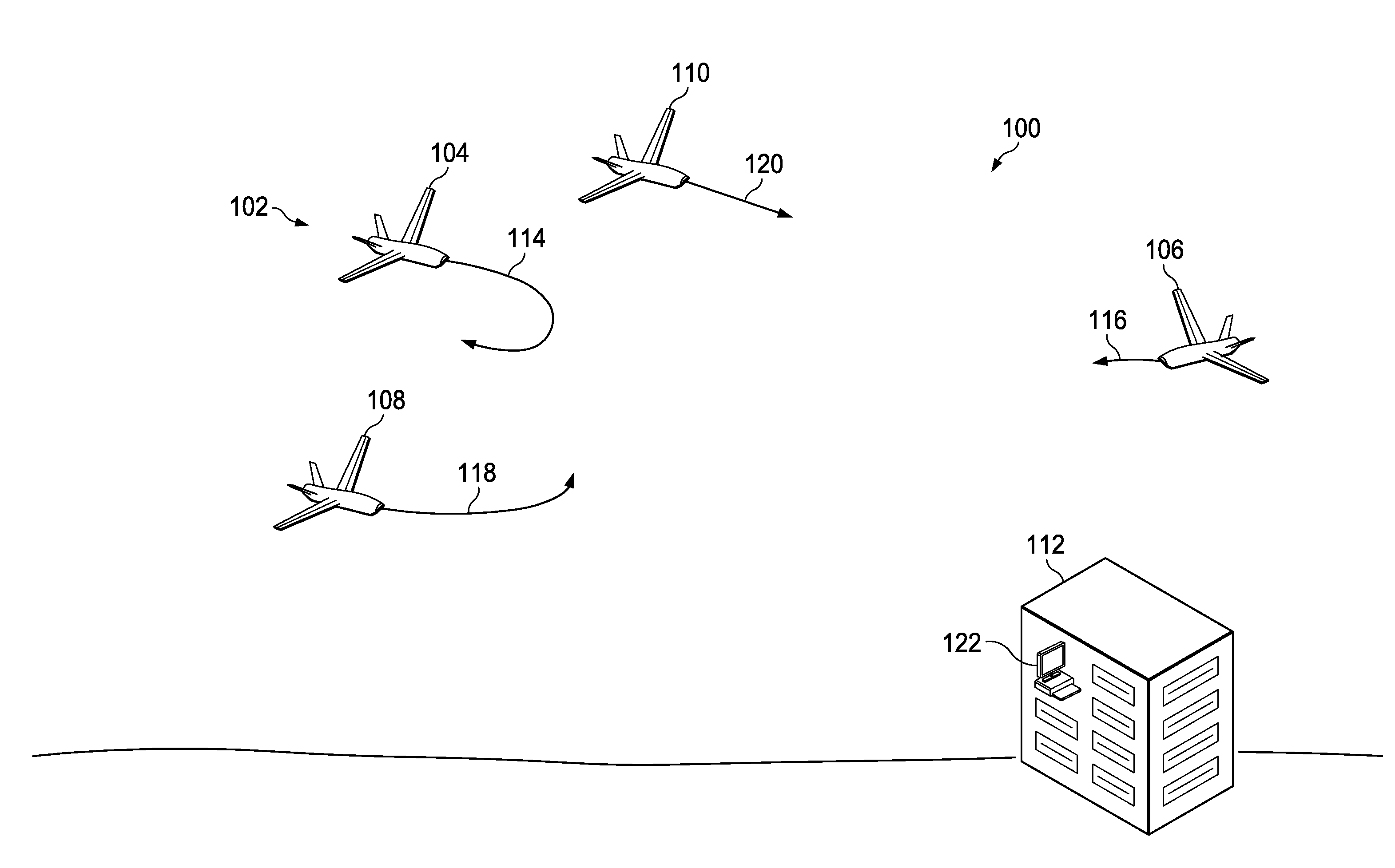
Further, as the number of unmanned aerial vehicles increases and the complexity of the planned routes increases the number of locations in which an overlap occurs, the display of the planned routes may become difficult to use.
As a result, the display of the planned routes may not be as useful as desired for an operator managing the unmanned aerial vehicles.

Method used


Image

  • Aircraft navigation system
  • Aircraft navigation system
  • Aircraft navigation system

Examples


Embodiment Construction

[0023]The illustrative embodiments recognize and take into account one or more different considerations. For example, the illustrative embodiments recognize and take into account that displays of routes may be simplified by reducing other information on a display containing a top-down view. For example, terrain, symbols, and other information may be filtered to reduce the amount of information on the display. The illustrative embodiments also recognize and take into account that the use of color schemes and line styles for different aircraft also may be used to increase the emphasis of routes.

[0024]The illustrative embodiments recognize and take into account that filtering a display of routes to emphasize the routes may allow the operator to focus more on the routes, but may remove other information that is desirable for operating the unmanned aerial vehicles. Further, other solutions such as using color schemes and line styles may not follow rules or regulations that may be in plac...


PUM


Abstract

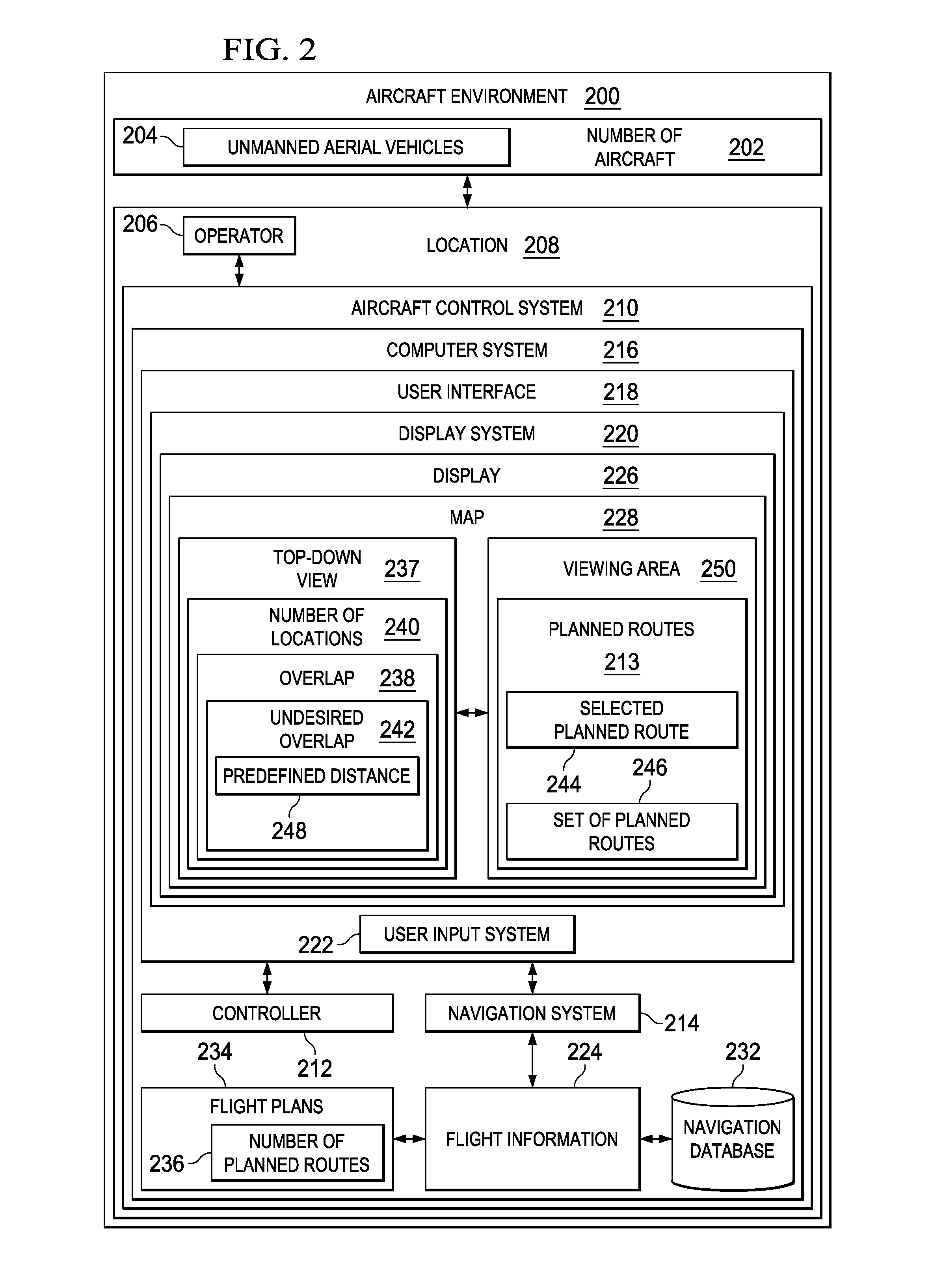
A method and apparatus for assisting in management of unmanned aerial vehicles. Planned routes are identified for the unmanned aerial vehicles. The planned routes are displayed on a map. A set of planned routes is identified that is within a predefined distance of a selected planned route during substantially a same point in time within a viewing area on the map.

Description

BACKGROUND INFORMATION[0001]1. Field[0002]The present disclosure relates generally to aircraft and, in particular, to displaying information used to control the movement of aircraft. Still more particularly, the present disclosure relates to a method and apparatus for displaying information for controlling the movement of unmanned aerial vehicles.[0003]2. Background[0004]Many aircraft have navigation displays for displaying information used to operate an aircraft. These navigation displays may display maps to an operator of the aircraft for use in operating the aircraft. These maps may include information, such as terrain, weather, navigation aids, wind, routes, direction of travel, route of travel, and other types of information. These types of displays are typically in the form of a map displayed in a top-down view. An icon representing the aircraft is typically displayed on a map in a location representing the current location of the aircraft.[0005]In some cases, an operator may ...

Claims


Application Information

Patent Timeline
Patent Type & Authority Patents(United States)
IPC IPC(8): G01C23/00G06F19/00
CPCG05D1/0027G05D1/0044G08G5/0013G08G5/0026G08G5/0069G08G5/0082G08G5/045G08G5/003G08G5/0043G08G5/04
Inventor DOWNS, JOSHUA, LEE
Owner THE BOEING CO
Learn More