
Method and apparatus for detecting GPS data-bit boundaries and detecting GPS satellite-signal reception

a technology of data-bit boundaries and satellite signals, applied in the field of global positioning satellite (gps) signal reception, can solve the problems of signal reception discriminating apparatus not being able to detect data-bit boundaries in the coherent process, and the noise also contained in satellite signals becoming larger

Active Publication Date: 2009-03-03
SAMSUNG ELECTRONICS CO LTD
View PDF5 Cites 6 Cited by
  • Summary
  • Abstract
  • Description
  • Claims
  • Application Information

AI Technical Summary

Problems solved by technology

However, in case where the noncoherent integration process is performed, the noise also contained in the satellite signal becomes larger as the satellite signal becomes larger.
Subsequently, the conventional satellite-signal reception discriminating apparatus cannot detect the data-bit boundary in the coherent process.

Method used


Image

  • Method and apparatus for detecting GPS data-bit boundaries and detecting GPS satellite-signal reception
  • Method and apparatus for detecting GPS data-bit boundaries and detecting GPS satellite-signal reception
  • Method and apparatus for detecting GPS data-bit boundaries and detecting GPS satellite-signal reception

Examples


Embodiment Construction

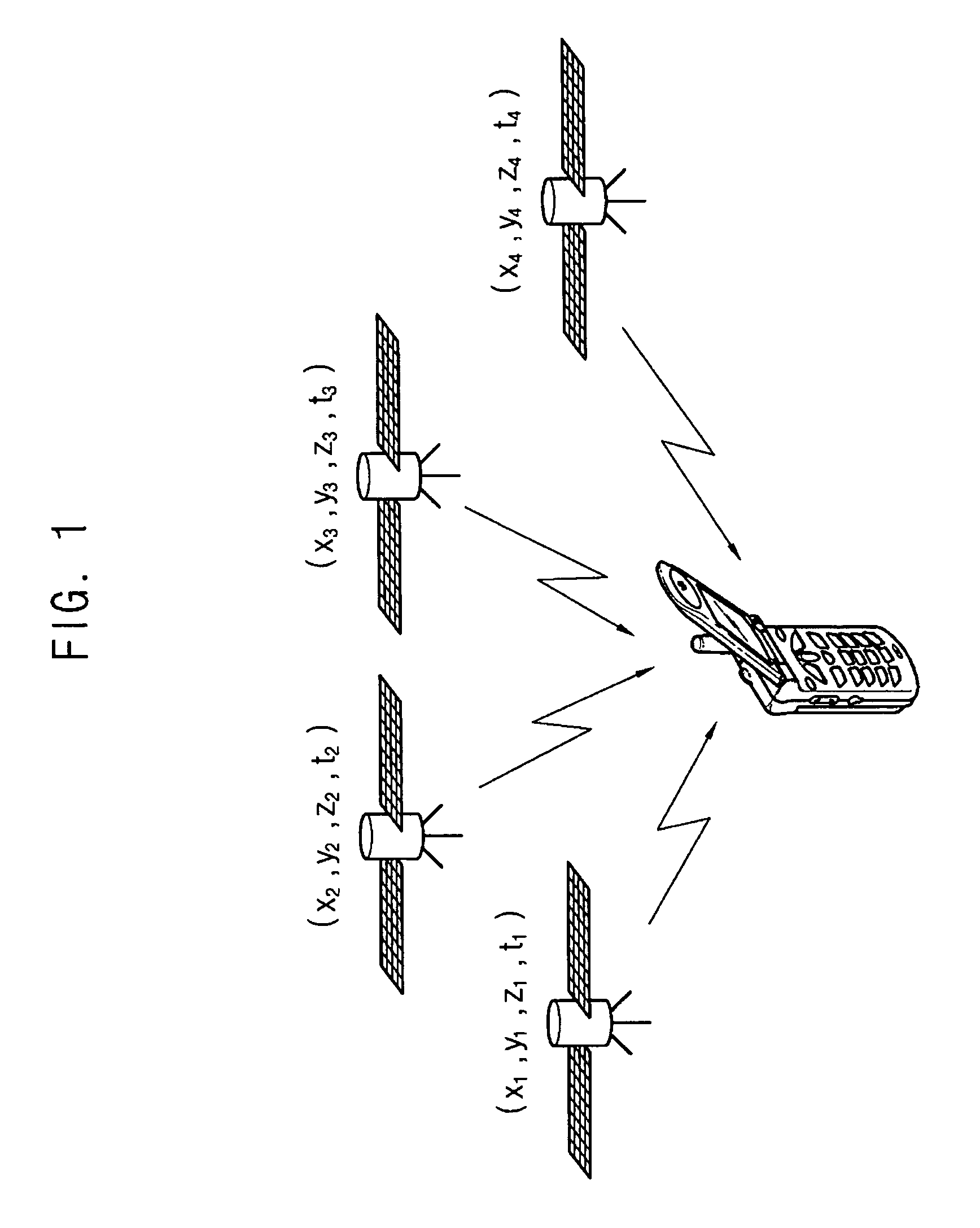
[0037]FIG. 1 is a schematic diagram showing an example of a global positioning system (GPS) for determining the position of a GPS terminal.

[0038]Referring to FIG. 1, position information of at least 3 satellites of approximately 30 satellites is needed for determining the position of a GPS receiver. However, the position information of another satellite is required because the times set for the GPS receiver and the satellites are different from each other. Ultimately, the positions of at least four satellites are required for the position detection of the GPS receiver.

[0039]The position of the satellites can be tracked when the PN codes and delay times of signals transmitted from the satellites are given. The satellite signals are transmitted from the satellites to the GPS receiver at the speed of light. However, the GPS receiver can receive the satellite signals at a frequency different from a predetermined frequency due to a Doppler effect. Therefore, the GPS receiver requires the...


PUM


Abstract

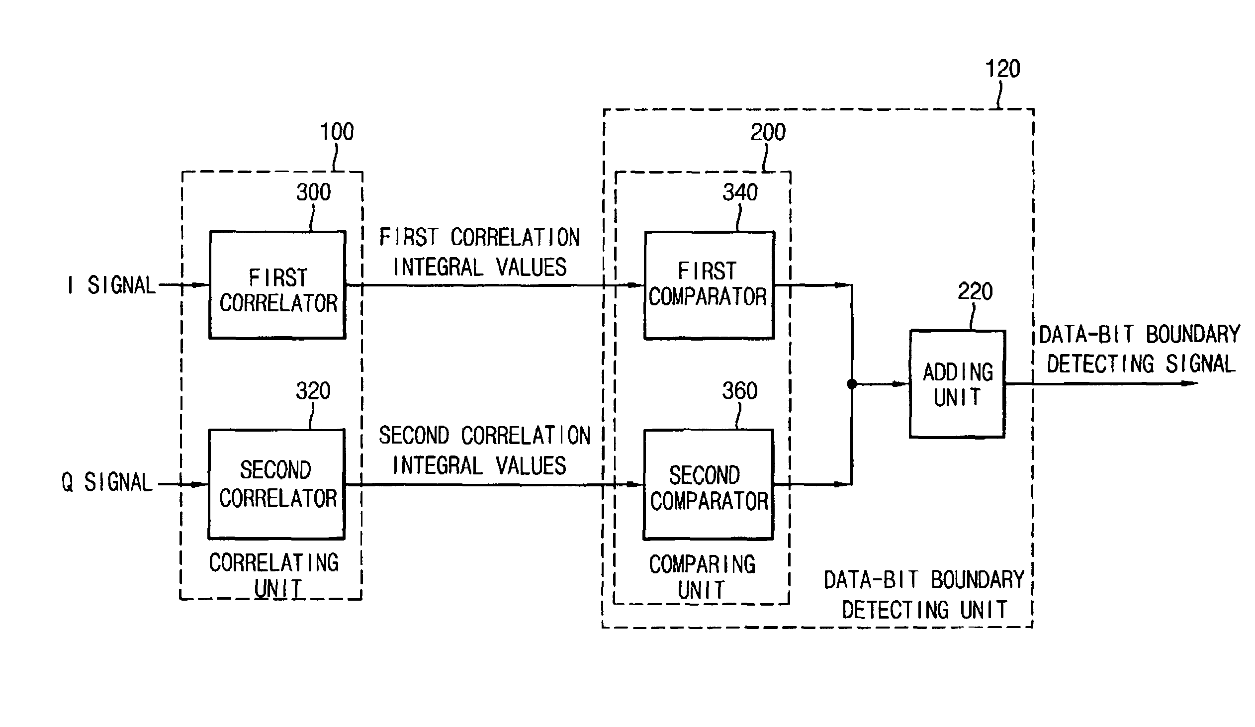
Method and apparatus for detecting 50 Hz GPS data-bit boundaries and detecting satellite-signal reception. The apparatus includes a correlating unit and a data-bit boundary detecting unit. The correlating unit outputs first (I) correlation integral values and second (Q) correlation integral values sequentially by calculating a correlation integrals between a satellite pulse train and a replica PN code. The data-bit boundary detecting unit changes the sign of each of the first (I) correlation integral values and second (Q) correlation integral values, based on comparing each of the first and second correlation integral values with an immediately previously outputted (first or second, respectively) correlation integral value, and generates data-bit boundary detection signals having information corresponding to the data-bit boundary using the changed correlation integral values. Thus, the data-bit boundary in GPS satellite signals can be detected.

Description

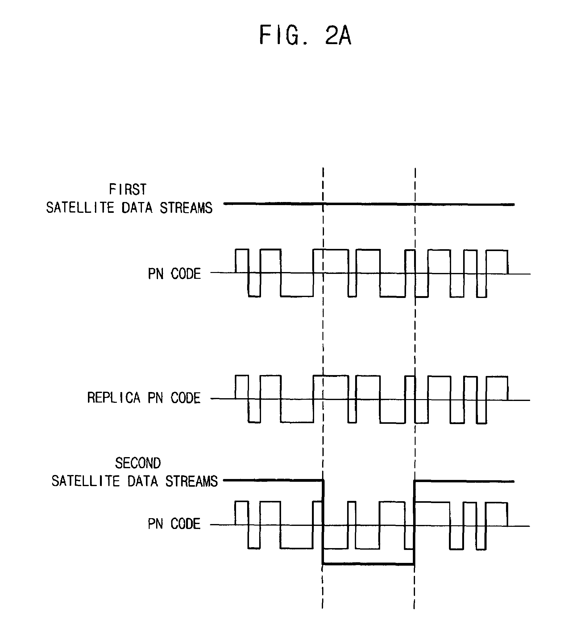
CROSS REFERENCE TO RELATED APPLICATION[0001]This application claims priority under 35 USC § 119 to Korean Patent Application 2003-93550 filed on Dec. 19, 2003, the contents of which are herein incorporated by reference in its entirety for all purposes.BACKGROUND OF THE INVENTION[0002]1. Field of the Invention[0003]The present invention relates to global positioning satellite (GPS) signal reception, and more particularly to a method and an apparatus for detecting a data-bit boundary to discriminate whether a satellite signal is received.[0004]2. Description of the Related Art[0005]A satellite signal transmitted from a satellite to a GPS receiver includes a satellite pulse train, which is the product of a satellite data stream and a Pseudo-Noise (PN) Code. GPS receivers calculate the range from the receiver to a satellite. Once the range to a satellite is known, the receiver knows it lies somewhere on a sphere of radius equal to this range. If the range to a second satellite is found,...

Claims


Application Information

Patent Timeline
Patent Type & Authority Patents(United States)
IPC IPC(8): H04B1/00G01S1/00H04B1/707
CPCG01S19/24H04B1/707H04B1/709
Inventor CHO, DONG-SIK
Owner SAMSUNG ELECTRONICS CO LTD
Learn More