Displaying data
a technology for displaying data and data, applied in the field of displaying data, can solve the problems of large data storage, difficult to compute elevation at other points or create new topographical lines for elevation levels, and the inability to divide digital maps into tiles
- Summary
- Abstract
- Description
- Claims
- Application Information
AI Technical Summary
Benefits of technology
Problems solved by technology
Method used
Image

Examples
Embodiment Construction
of U.S. Pat. No. 5,902,347, to Backman et al. describes in much detail how a photo image of a map is divided into tiles and then compressed with TIFF. There is no discussion about any digital maps. In fact, a digital map cannot be divided into tiles by simply cutting a whole map. A digital map is built out of tiles from the beginning and they are usually not compressed in a conventional sense but are bit encoded to provide a maximum speed of map reconstruction.
By the time of the issuance of U.S. Pat. No. 5,902,347, to Backman et al., there were several commercial handheld GPS systems capable of displaying vector maps on the device screen. One of such devices, Nav 6000, was produced by Magellan from 1996. These vector maps were constructed from the tiles.
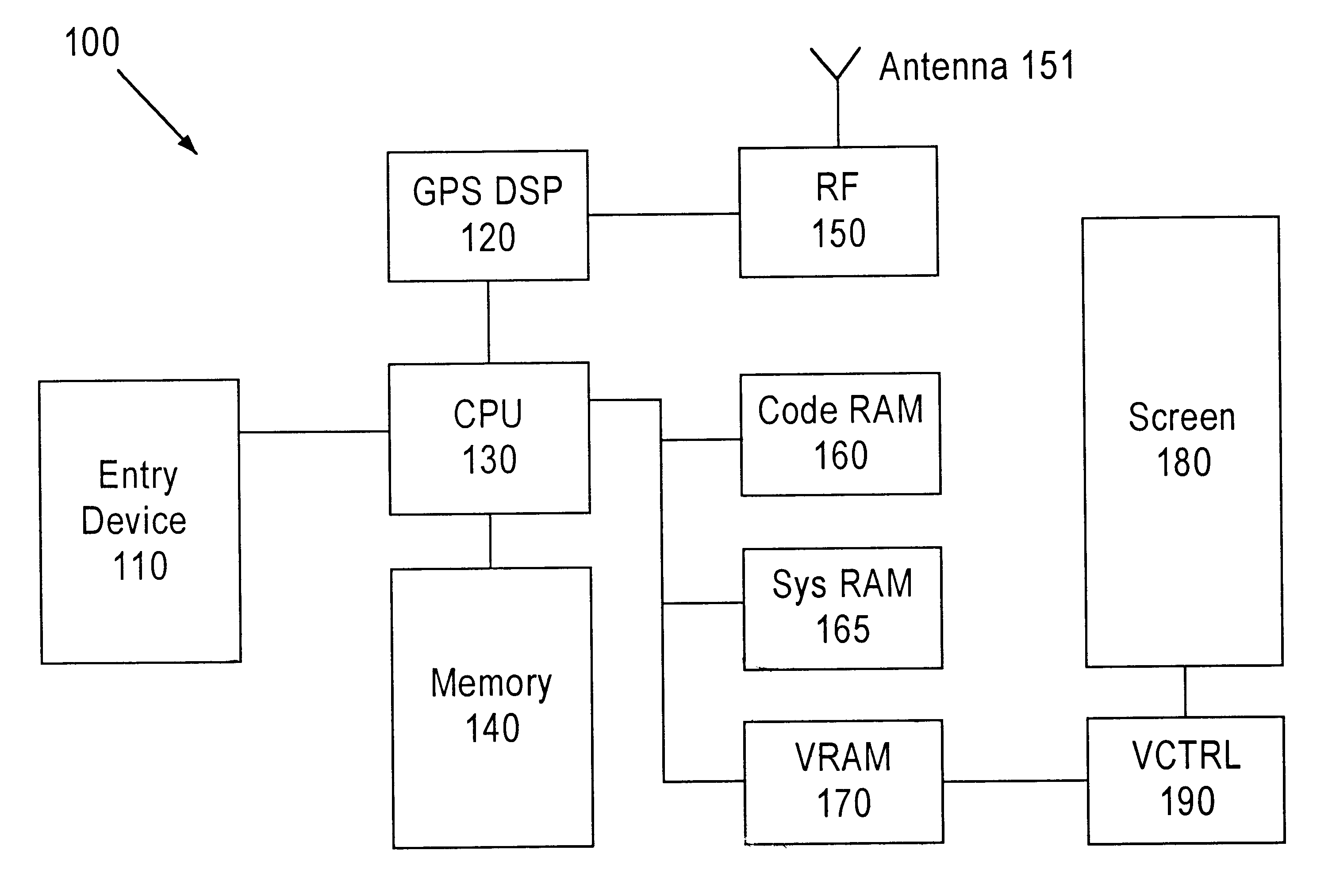
The present invention is not concerned with a bit image or with a vector map. Rather, the present invention deals with Digital Elevation Model data, which is a quite different from both. DEM allows computing true elevation in any poi...
PUM
 Abstract
Description
Claims
Application Information
 - R&D
- Intellectual Property
- Life Sciences
- Materials
- Tech Scout
- Unparalleled Data Quality
- Higher Quality Content
- 60% Fewer Hallucinations
Browse by: Latest US Patents, China's latest patents, Technical Efficacy Thesaurus, Application Domain, Technology Topic, Popular Technical Reports.
© 2025 PatSnap. All rights reserved.Legal|Privacy policy|Modern Slavery Act Transparency Statement|Sitemap|About US| Contact US: help@patsnap.com