
Navigational reference location determination using reverse lookup location identifier

a technology of location determination and navigation reference, applied in traffic control systems, navigation instruments, instruments, etc., can solve the problems of cumbersome system entry of long addresses, inability to provide a simple way to enter destination addresses, and difficulty in determining the location of reference points, so as to improve the accuracy and speed and improve the accuracy of navigational reference points. , the effect of reducing the number of navigational reference points

Inactive Publication Date: 2008-07-10
IBM CORP
View PDF4 Cites 55 Cited by
  • Summary
  • Abstract
  • Description
  • Claims
  • Application Information

AI Technical Summary

Benefits of technology

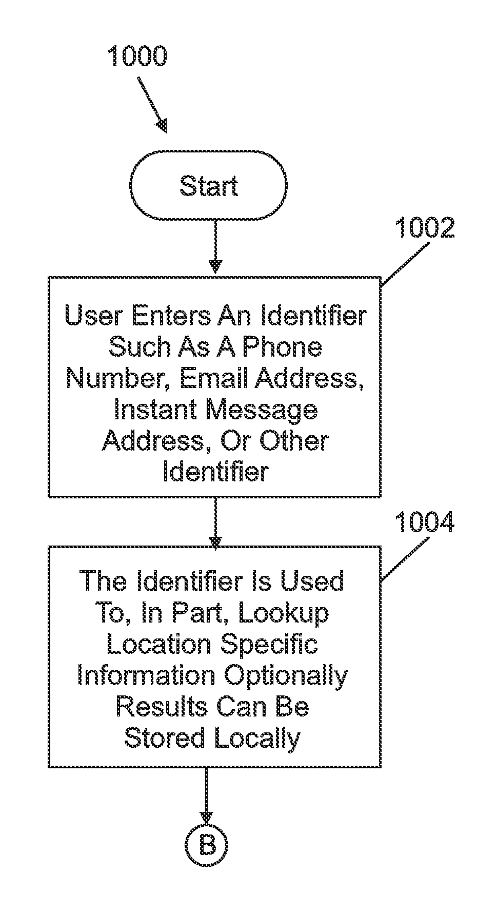
The invention provides a method for easily entering location identifier data into a navigational system to quickly and accurately determine location specific information, such as a street address or other information that can be used by the system to display maps and directions. This method allows for faster and more intuitive use of the navigational system, as users can enter location identifier data without having to manually enter a complete location street address. Overall, the invention improves the efficiency and ease of use of navigational systems.

Problems solved by technology

However, they fail to provide a simple way to enter destination addresses.
However, entering addresses is sometimes difficult for a few reasons.
First it may be cumbersome to enter long addresses in systems that have constrained input capabilities such as small keyboards, awkward touch screens, or no standard data entry controls to name a few.
In addition, once a user takes the time to enter an address often the actual address may not be available, many similar address are returned, or discrepancies in the formatting of the location number or street name result in the navigation system being unable to locate the correct location.
Though zooming in and trying to pin point a start or destination location may seem intuitive it is problematic when your start or destination are not landmarks and don't appear on the map, such can be the case for many regular addresses.
In some navigation systems a user may be able to jump to a particular location on a map by supplying latitude and longitude but this method can also be cumbersome and very non-intuitive.

Method used


Image

  • Navigational reference location determination using reverse lookup location identifier
  • Navigational reference location determination using reverse lookup location identifier
  • Navigational reference location determination using reverse lookup location identifier

Examples


Embodiment Construction

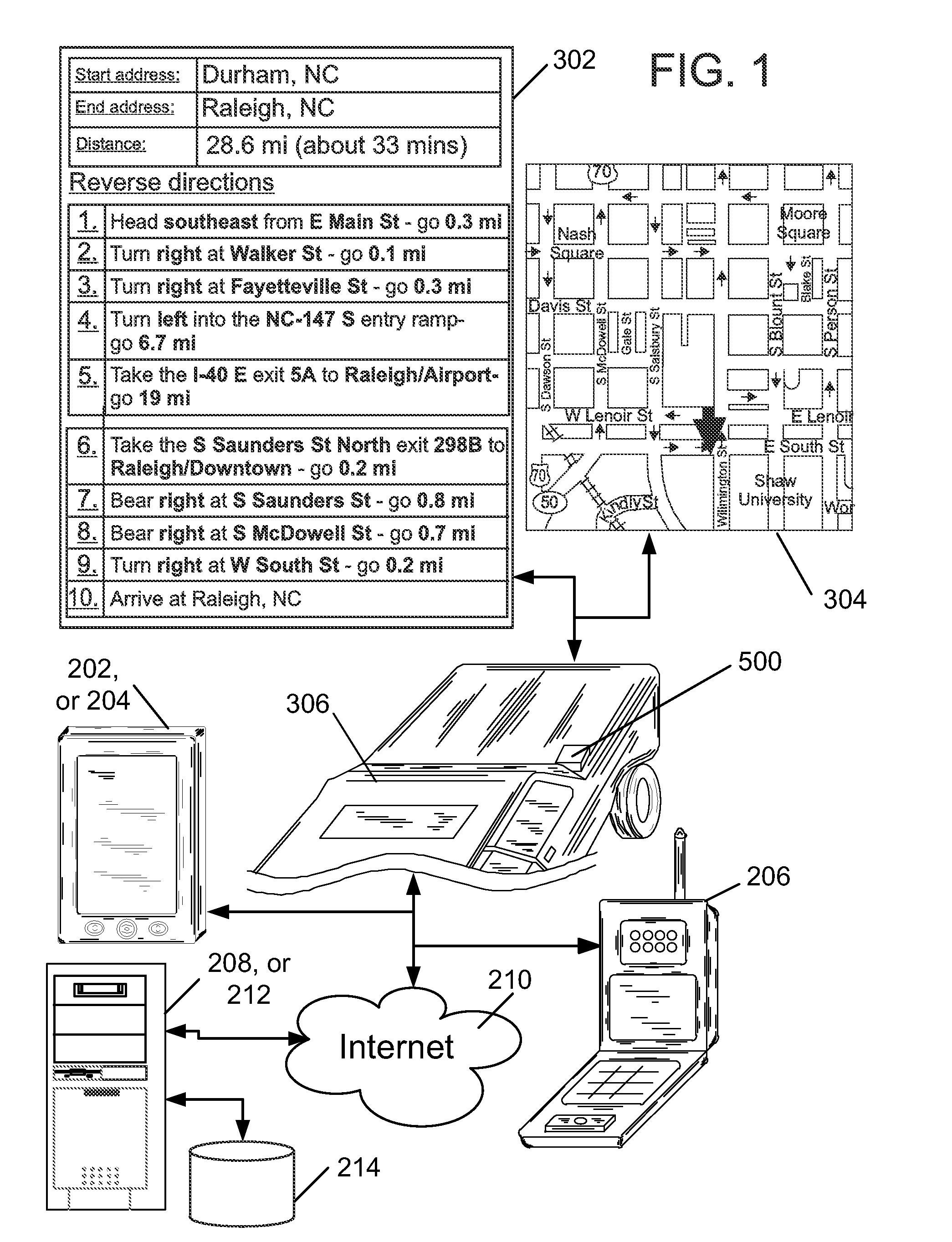
[0026]Turning now to the drawings in greater detail, it will be seen that in FIG. 1 there is one example of a plurality of portable data processing devices and a vehicle 306 equipped with a navigational system 500 utilizing location identifier data in a reverse lookup process to provide navigational maps 304, and or directions 302.

[0027]In this regard, a plurality of data processing devices 202, 204, 206, 208, and or 212, and a navigational system 500 utilize location identifier data such as a phone number, caller ID, email address, instant message address, or other location identifier data to perform a reverse lookup query resulting in obtaining and displaying more detailed location specific information.

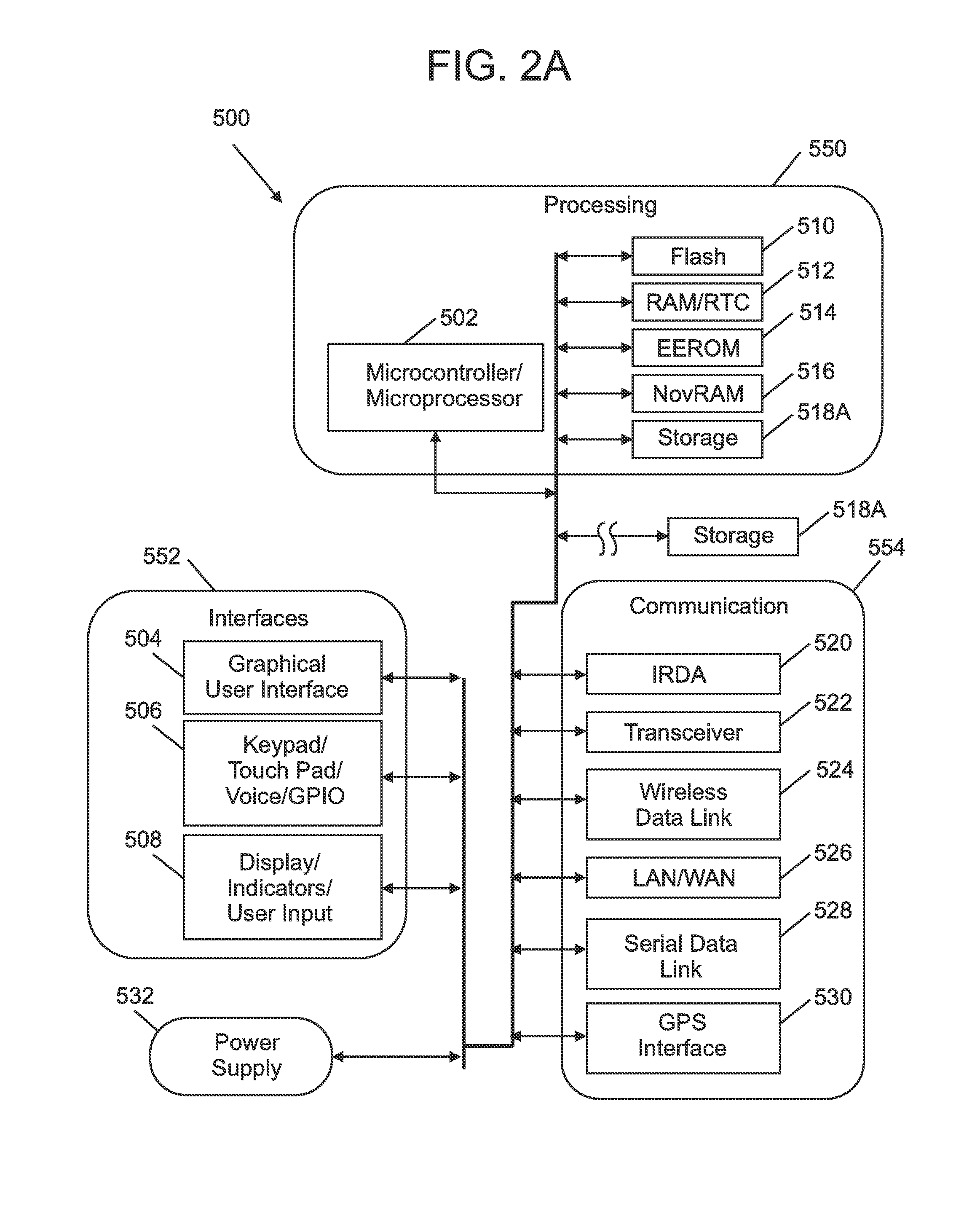
[0028]In an exemplary embodiment, a user can manually enter the location identifier data into the navigational system 500, and or the location identifier can be data communicated from other data processing devices locally and or remotely, including from global network based data pro...


PUM


Abstract

This embodiment of the invention relates to a navigational system having at least navigational software capable of determining and or displaying maps, directions, and or for providing other location specific information. The navigational system is capable of accepting location identifier data. Such location identifier data can include a phone number, caller ID, an email address, an instant message address, and or other types and or kinds of location identifier data. In response, the navigational system performs a reverse lookup query using the location identifier data to determine the location street address, and or other location specific information. This location street address, and or other location specific information are then used to provide maps, directions, and other location information to a user by way of the navigational system. The navigational system can obtain information from local data processing resources, and or optionally from remote global network based data processing resources.

Description

TRADEMARKS[0001]IBM® is a registered trademark of International Business Machines Corporation, Armonk, N.Y., U.S.A. Other names used herein may be registered trademarks, trademarks or product names of International Business Machines Corporation or other companies.BACKGROUND OF THE INVENTION[0002]1. Field of the Invention[0003]An embodiment of the invention relates to a navigational system having at least navigational software capable of determining and or displaying maps, directions, and or for providing other location specific information. More particularly, this embodiment of the invention relates to a navigational system capable of accepting location identifier data. Such location identifier data can include a phone number, caller ID, an email address, an instant message address, and or other types and or kinds of location identifier data. In response, the navigational system performs a reverse lookup using the location identifier data to determine the locations address (also ref...

Claims


Application Information

Patent Timeline
Patent Type & Authority Applications(United States)
IPC IPC(8): G01C21/00G06F17/30
CPCG01C21/362G01C21/3611
Inventor NARAYANASWAMI, CHANDRASEKHAR
Owner IBM CORP
Learn More