
Navigational system, as well as method for illustrating a road map with isolines

a navigation system and road map technology, applied in the field of navigation systems, can solve the problems of relative little information displayed on the monitor of the navigation system, hazardous uncertainty of the driver of the motor vehicle, and user disorientation, so as to overcome the inherent disadvantages, improve the user's experience, and facilitate the use of the device and the method

Inactive Publication Date: 2008-04-10
NAVIGON AG
View PDF4 Cites 14 Cited by
  • Summary
  • Abstract
  • Description
  • Claims
  • Application Information

AI Technical Summary

Benefits of technology

"The present invention is a navigation system and method that improves orientation and information content by using isoline data and elevation data in a road map. The system includes a processor that selects isoline data and displays it on a display device. The isoline data can be shaded or filled with different colors to make it easier for the user to understand the terrain. The invention allows for a more intuitive and efficient orientation based on the image displayed on the monitor of the navigation system. The invention can be used with different road maps and isoline data files, and it reduces the storage capacity and data transmission required for illustrating the isolines."

Problems solved by technology

However, when larger map scales are selected by the navigation system while driving at higher speeds or on interurban routes, in particular, it may occur that only relatively little information is displayed on the monitor of the navigation system.
This can result in only a few, if any, orientation elements being displayed on the respective monitor image in addition to the main roads while driving—particularly in sparsely populated areas.
This naturally results in the disorientation of the user because the image illustrated on the monitor practically does not provide any clues that would enable the user to check the concurrence between the map image illustrated on the navigation system and the actual surroundings or landscape in such instances.
This inherent limitation of the state of the art in the illustration of maps on navigation systems can affect the driver's orientation, particularly in unfamiliar areas, or even lead to possibly hazardous uncertainty of the driver of the motor vehicle.

Method used


Image

  • Navigational system, as well as method for illustrating a road map with isolines
  • Navigational system, as well as method for illustrating a road map with isolines
  • Navigational system, as well as method for illustrating a road map with isolines

Examples


Embodiment Construction

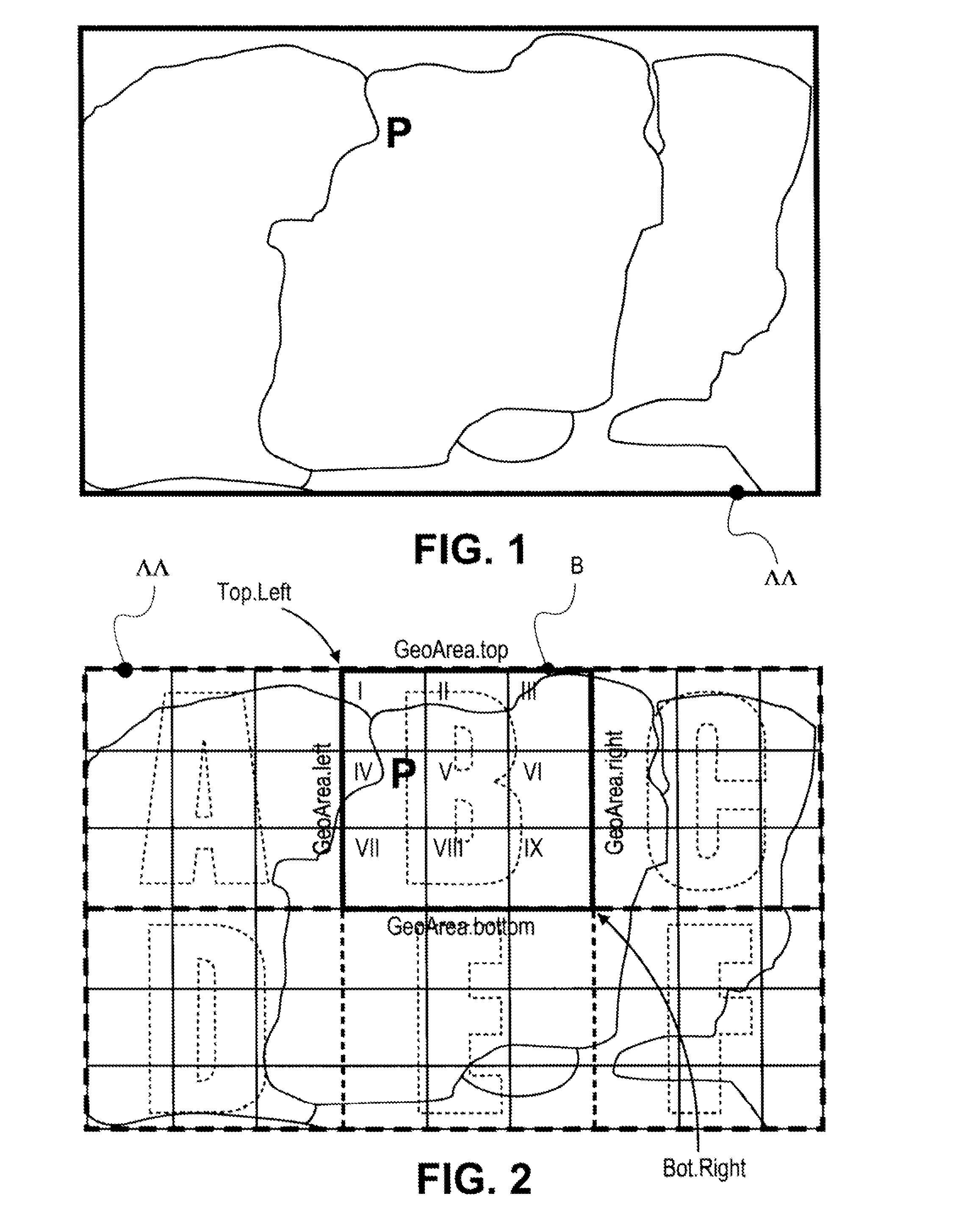
[0045]FIG. 1 shows a schematic representation of a geographic region or a map M, within the map region of which the navigation system such as, for example, a navigation system of a motor vehicle, is currently situated. One can distinguish a few schematically illustrated area boundaries, as well as the instantaneous geographic position P of the motor vehicle and of the navigation system which is determined by the navigation system and marked with “P,”

[0046]FIG. 2 shows the same map region M as FIG. 1, wherein a grid is superimposed on the map region M in FIG. 2. In this case, the grid corresponds to a logical division of the map region M into tiles. The division of the map region M into tiles serves for storing the isoline data assigned to the map region M—for example, the data of isohypses or contour lines—in corresponding isoline data files in a precisely structured fashion.

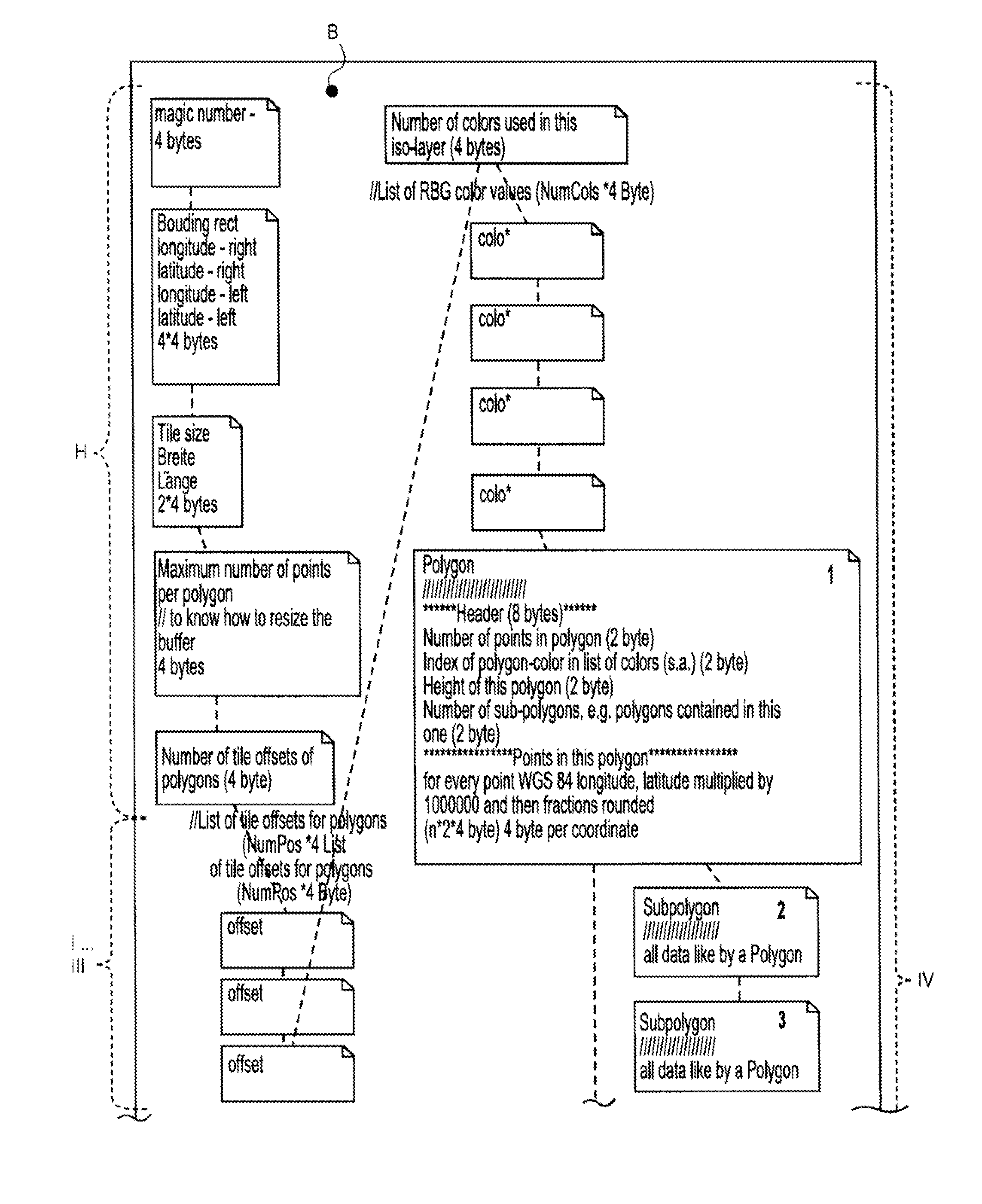
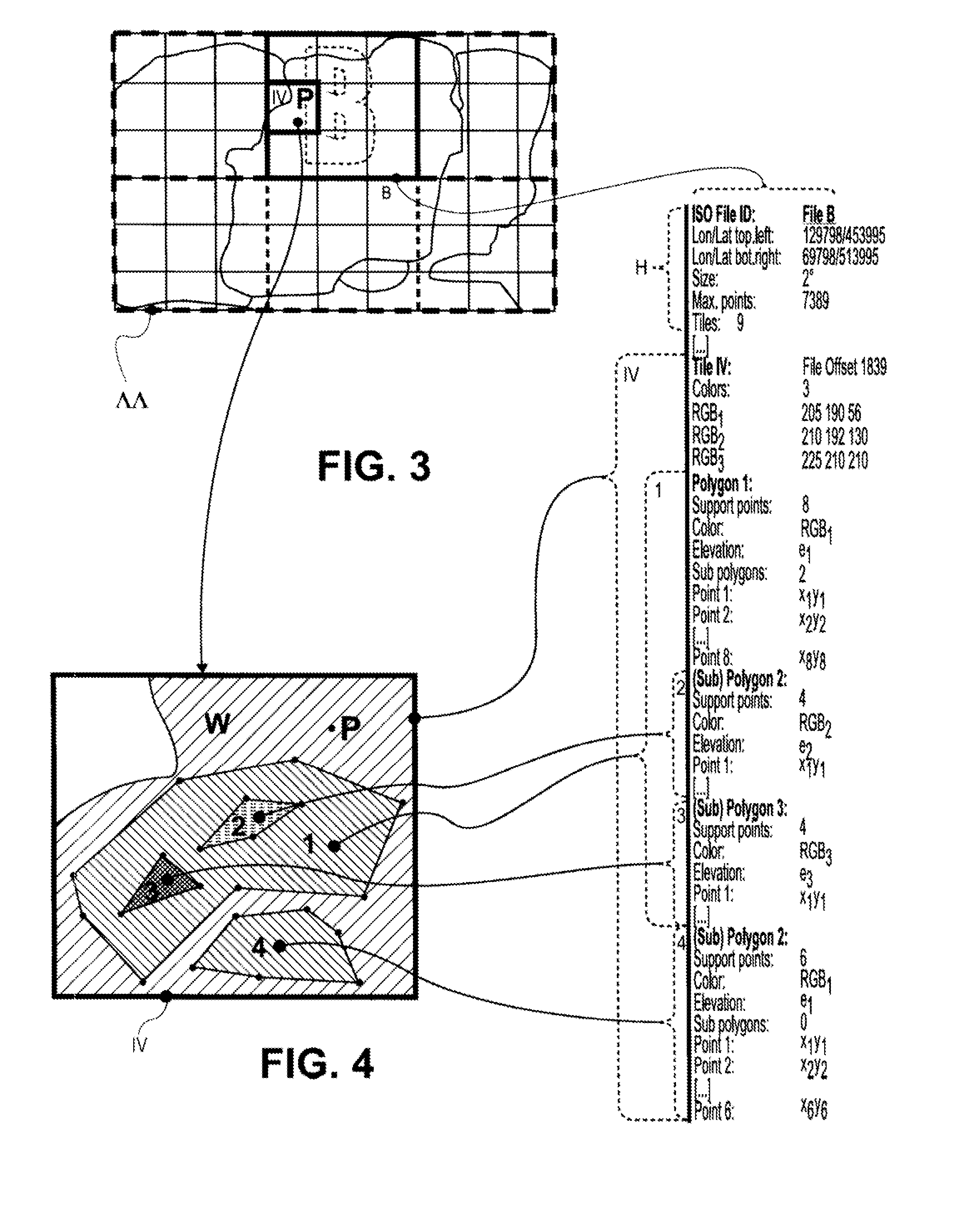
[0047]The square B bordered by a bold line in FIG. 2 symbolizes the extent of the geographic area B or the ex...


PUM


Abstract

The invention pertains to a navigation system, for example, for a motor vehicle, as well as to a method for simultaneously displaying isolines and a road map. The navigation system comprises a processor as well as a display device for displaying a road map. The invention is characterized in that the processor is designed for selecting isoline data and for displaying isolines (1, 2, 3, 4 . . . ) on the display device, wherein the illustrated road map and the isolines that correspond to the illustrated road map can be superimposed on the display device. The invention allows a much better and intuitive orientation for the user with the aid of the expanded illustration on the monitor of the navigation system. The method and navigation system ensure a technically robust combination of existing road maps and separate isoline data, namely of any arbitrary origin, which can be realized in a cost-efficient fashion.

Description

CROSS-REFERENCE TO RELATED APPLICATIONS[0001]The present patent application claims priority from German Patent Application No. 10 2006 048 182.8, filed on Oct. 10, 2006.BACKGROUND OF THE INVENTION[0002]The invention pertains to a navigation system, particularly for a motor vehicle, according to the preamble of claim 1, as well as to a method for simultaneously displaying isolines on a road map according to claim 11.[0003]Navigation systems for determining the instantaneous position, for example, of persons or motor vehicles, or for determining and displaying driving routes are known. Navigation systems of this type generally comprise a display device or a monitor, on which a section of a road map can be illustrated. The monitor usually shows, in essence, the course of roads and paths within the displayed map section, as well as at least a few characteristics of the surroundings such as, for example, the contours of buildings, city areas or tree-covered regions.[0004]Navigation syste...

Claims


Application Information

Patent Timeline
Patent Type & Authority Applications(United States)
IPC IPC(8): G01C21/30
CPCG09B29/12G01C21/367
Inventor HEUSER, MICHAEL
Owner NAVIGON AG
Learn More