Electronic map with a drawing feature
a drawing feature and electronic map technology, applied in the field of electronic maps, can solve the problems of inconvenient use of electronic maps, difficulty in finding a specific location in the zooming-in map, and electronic maps have not offered network information of businesses
- Summary
- Abstract
- Description
- Claims
- Application Information
AI Technical Summary
Benefits of technology
Problems solved by technology
Method used
Image
Examples
Embodiment Construction
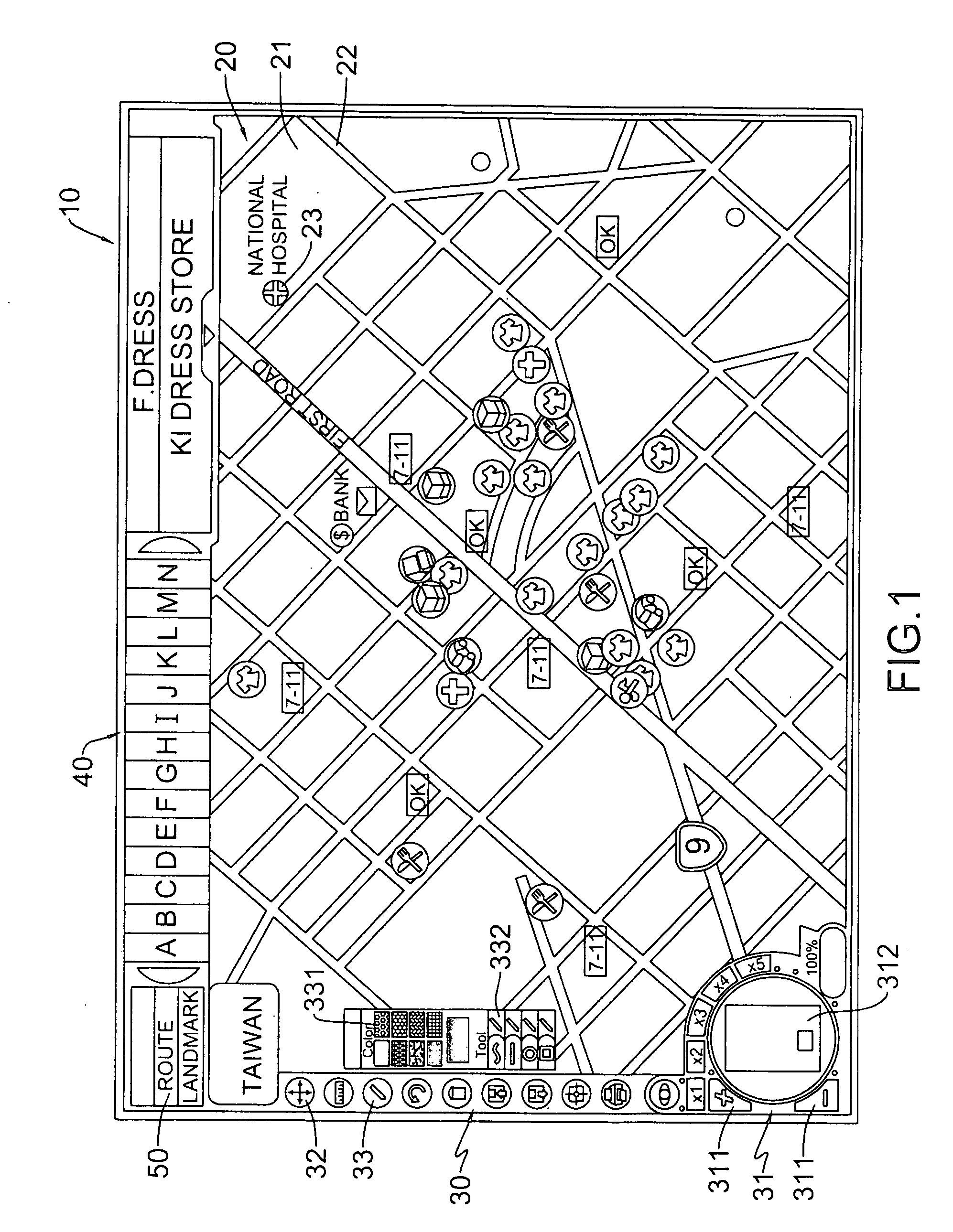
[0013] With reference to FIGS. 1, an electronic map in accordance with the present invention comprises a graphic map, defining means, grouping means, displaying means and shifting means and drawing means.
[0014] The graphic map (20) comprises multiple digital landform objects (21), digital route objects (22) and digital landmark objects (23).
[0015] The defining means is defining the digital landform objects (21), digital route objects (22) and digital landmark objects (23) to individual objects, respectively.
[0016] The grouping means is dividing the digital route object (22) into national road, provincial road or local road in Road Bar (30) according to the characters of digital route object (22) and dividing the digital landmark objects (23) into Food, Clothing, Housing, Transportation, Education or Entertainment in Landmark Bar (40) according to the characters of digital landmark objects (23);
[0017] The displaying means is establishing relative coordinate relationship between d...
PUM
 Abstract
Description
Claims
Application Information
 - R&D
- Intellectual Property
- Life Sciences
- Materials
- Tech Scout
- Unparalleled Data Quality
- Higher Quality Content
- 60% Fewer Hallucinations
Browse by: Latest US Patents, China's latest patents, Technical Efficacy Thesaurus, Application Domain, Technology Topic, Popular Technical Reports.
© 2025 PatSnap. All rights reserved.Legal|Privacy policy|Modern Slavery Act Transparency Statement|Sitemap|About US| Contact US: help@patsnap.com


