Combined Navigation Method of Visual Navigation and Inertial Navigation Based on Aircraft
A technology of integrated navigation and inertial navigation, applied in the field of integrated navigation
- Summary
- Abstract
- Description
- Claims
- Application Information
AI Technical Summary
Problems solved by technology
Method used
Image

Examples
Embodiment Construction
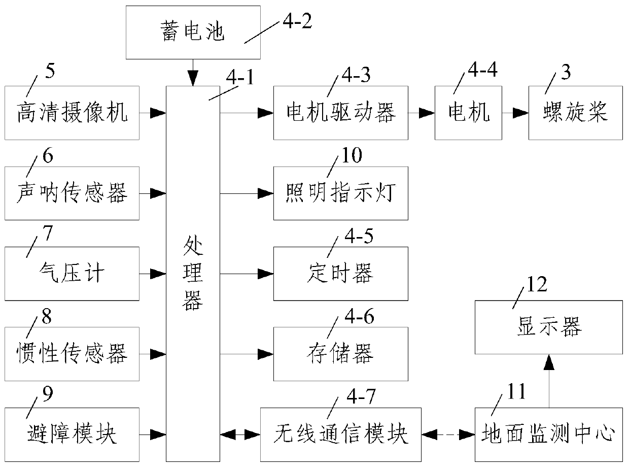
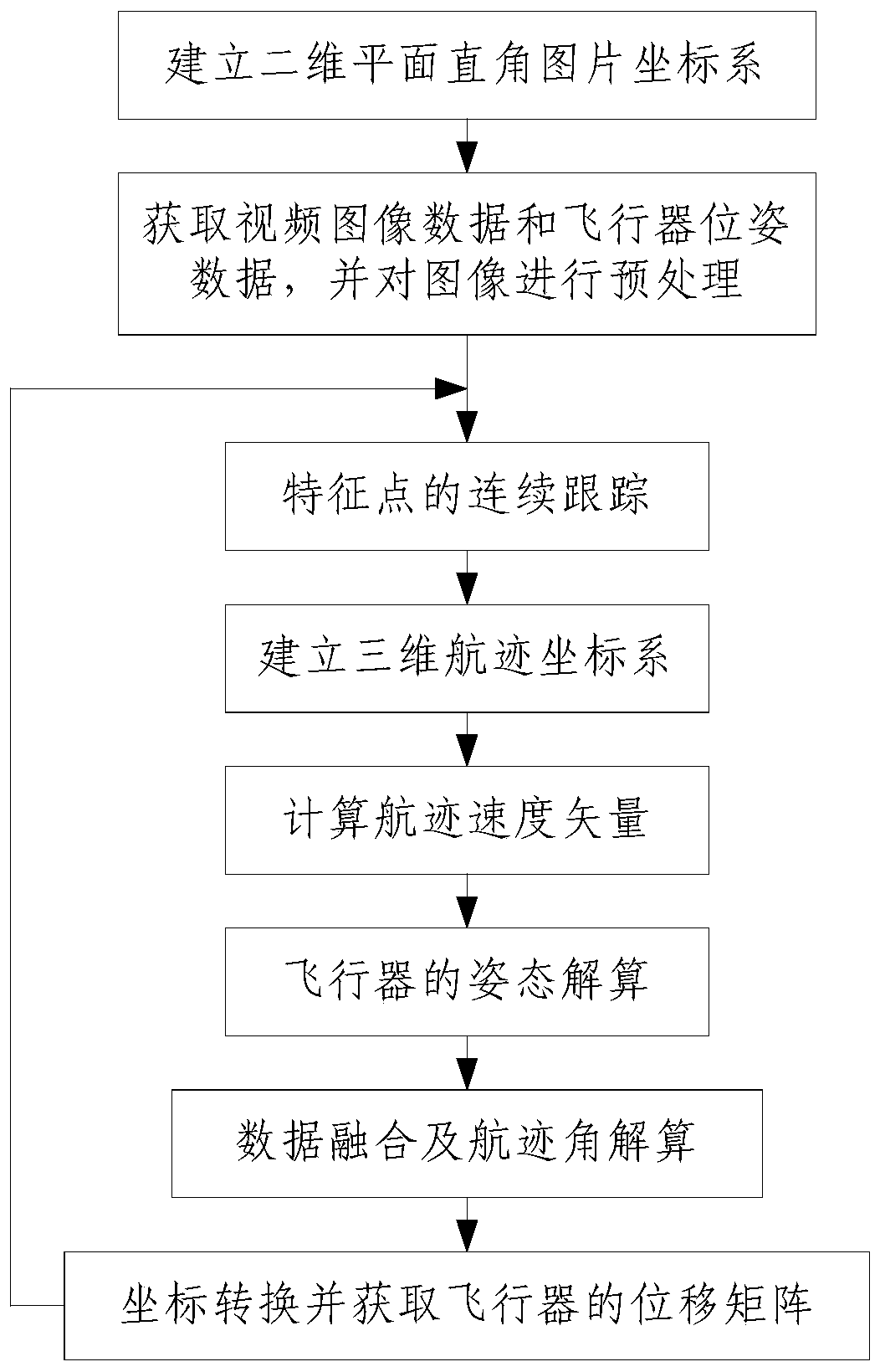
[0047] Such as Figure 1 to Figure 3 Shown, the combined navigation method of visual navigation and inertial navigation based on aircraft of the present invention comprises the following steps:
[0048] Step 1, establish a two-dimensional plane rectangular picture coordinate system: adopt the aircraft control unit 4 to establish a two-dimensional plane rectangular picture coordinate system, set up a two-dimensional plane rectangular picture coordinate system on the plane where the aircraft is parallel to the horizontal plane and take the starting point of the aircraft flight as the coordinate origin Department O k -x k the y k , where, taking the due east direction of the aircraft as the two-dimensional plane rectangular image coordinate system O k -x k the y k The x-axis of the aircraft takes the true north direction of the aircraft as the two-dimensional plane rectangular image coordinate system O k -x k the y k the y-axis;
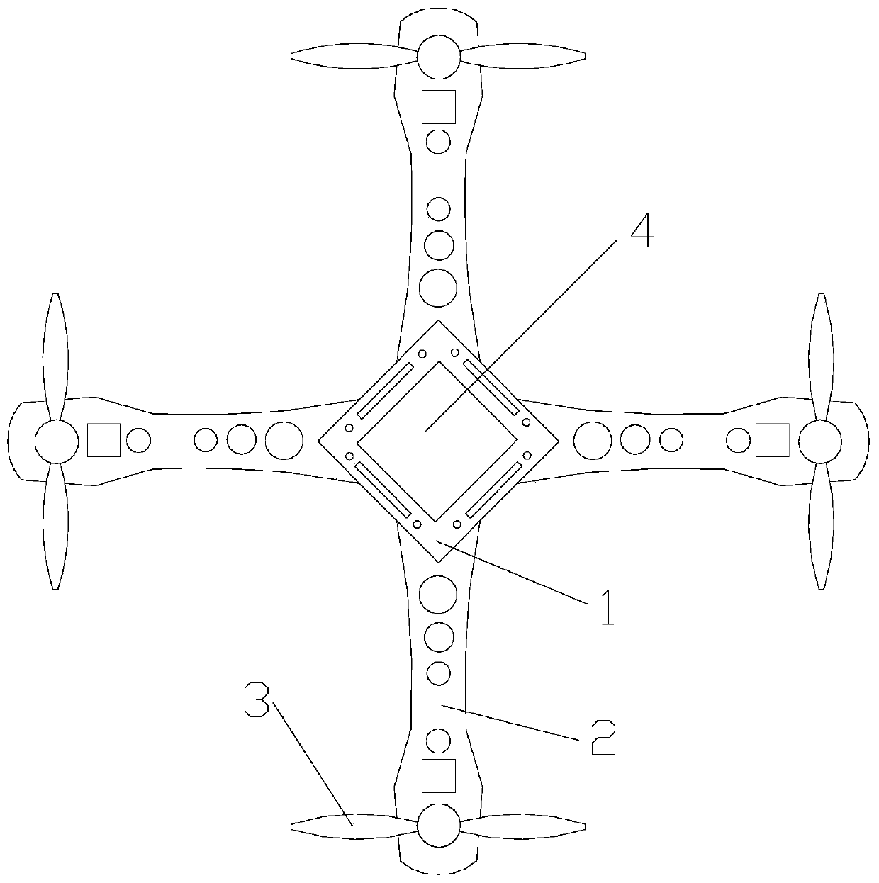
[0049] The aircraft is a four-axis aircr...
PUM
 Abstract
Description
Claims
Application Information
 - Generate Ideas
- Intellectual Property
- Life Sciences
- Materials
- Tech Scout
- Unparalleled Data Quality
- Higher Quality Content
- 60% Fewer Hallucinations
Browse by: Latest US Patents, China's latest patents, Technical Efficacy Thesaurus, Application Domain, Technology Topic, Popular Technical Reports.
© 2025 PatSnap. All rights reserved.Legal|Privacy policy|Modern Slavery Act Transparency Statement|Sitemap|About US| Contact US: help@patsnap.com