A Road Network Matching Method for GPS Trajectory Data of Public Transport
A trajectory data, road network matching technology, applied in the field of transportation, can solve the problem of complex search process and so on
- Summary
- Abstract
- Description
- Claims
- Application Information
AI Technical Summary
Problems solved by technology
Method used
Image
Examples
Embodiment Construction
[0056] The present invention will be further described in detail below in conjunction with the accompanying drawings, so that those skilled in the art can implement it with reference to the description.
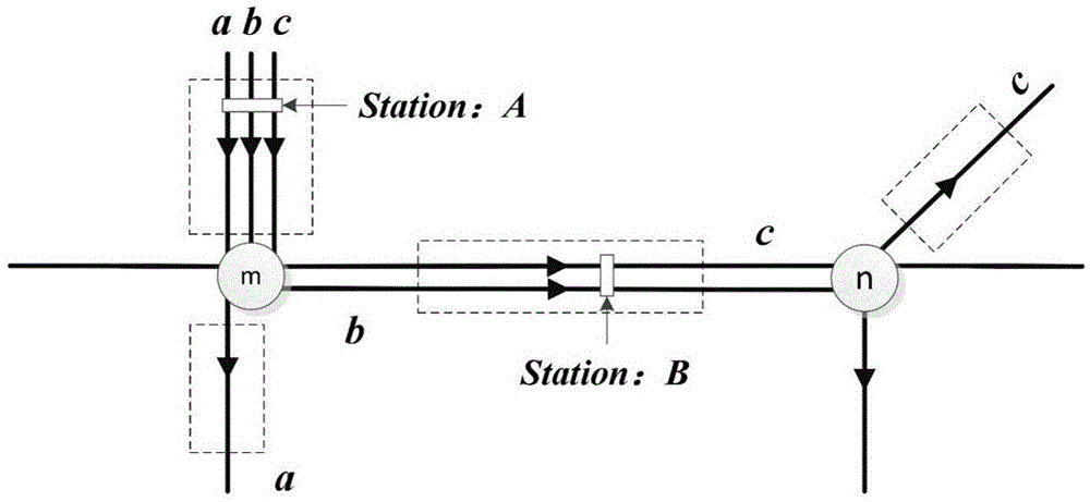
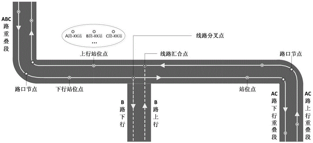
[0057] The invention provides a road network matching method for bus GPS track data, comprising:
[0058] Step 1, collect all GPS track data of a bus in a time period, each group of GPS track data includes time value and longitude and latitude coordinates, utilizes longitude and latitude coordinates to determine a track point, and all track points are sorted according to time sequence;
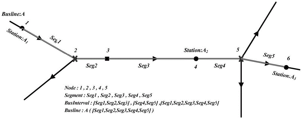
[0059] Step 2. Perform the following calculations for all track points in turn: in the public transport road network data structure, determine at least one candidate matching road segment for a track point and form a set of candidate matching road segments, and calculate the position of the track point on each candidate matching road segment The projected points of and take the projected poin...
PUM
 Abstract
Description
Claims
Application Information
 - R&D
- Intellectual Property
- Life Sciences
- Materials
- Tech Scout
- Unparalleled Data Quality
- Higher Quality Content
- 60% Fewer Hallucinations
Browse by: Latest US Patents, China's latest patents, Technical Efficacy Thesaurus, Application Domain, Technology Topic, Popular Technical Reports.
© 2025 PatSnap. All rights reserved.Legal|Privacy policy|Modern Slavery Act Transparency Statement|Sitemap|About US| Contact US: help@patsnap.com


