Acquisition and organization method of topographic data in virtual map
A technology of topographical data and virtual maps, applied in the direction of electrical digital data processing, special data processing applications, instruments, etc., can solve the problems of complex data and achieve the effect of convenient and reasonable use
- Summary
- Abstract
- Description
- Claims
- Application Information
AI Technical Summary
Problems solved by technology
Method used
Image
Examples
Embodiment Construction
[0031] The present invention will be described in detail below in conjunction with the accompanying drawings and specific embodiments.
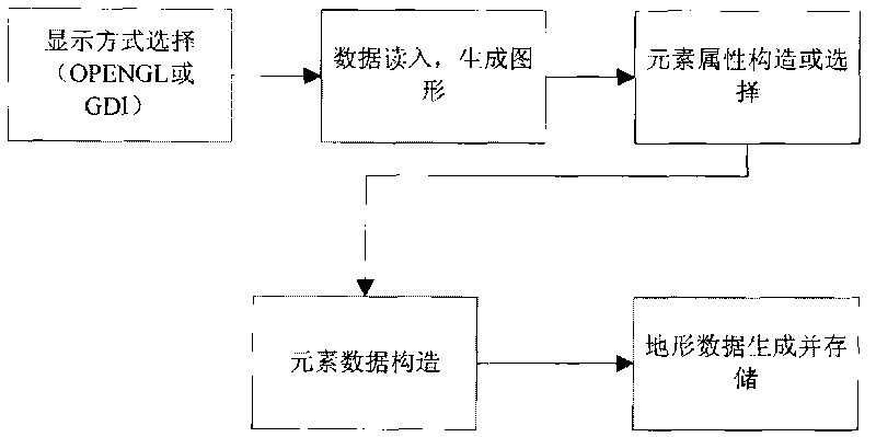
[0032] Such as figure 1 As shown, the acquisition and organization method of terrain data in the virtual map includes the following steps:
[0033] (1) Read data from the geographic information system database and generate corresponding graphics to draw a map;
[0034] (2) For various elements displayed in the map, select or create attributes belonging to each element;
[0035] (3) Construct the data corresponding to the newly generated elements;
[0036] (4) Store the selected or constructed element attributes and element data in a serialized manner as attribute files and data files, respectively.
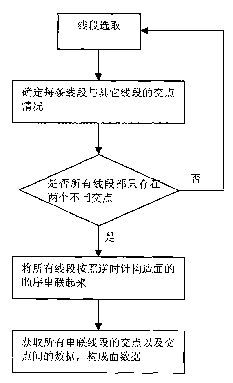
[0037] Through data reading, the data is divided into three types of organization: point, line, and surface according to the form of data belonging. Since the basic element of OpenGL surface drawing is a convex polygon, the boundary of the rea...
PUM
 Abstract
Description
Claims
Application Information
 - R&D
- Intellectual Property
- Life Sciences
- Materials
- Tech Scout
- Unparalleled Data Quality
- Higher Quality Content
- 60% Fewer Hallucinations
Browse by: Latest US Patents, China's latest patents, Technical Efficacy Thesaurus, Application Domain, Technology Topic, Popular Technical Reports.
© 2025 PatSnap. All rights reserved.Legal|Privacy policy|Modern Slavery Act Transparency Statement|Sitemap|About US| Contact US: help@patsnap.com


