Satellite remote sensor for typical fishery change and sea environment relationship
A satellite remote sensing, satellite technology, applied in surveying, mapping and navigation, measuring devices, instruments, etc., can solve problems such as less fishery relationship analysis
- Summary
- Abstract
- Description
- Claims
- Application Information
AI Technical Summary
Problems solved by technology
Method used
Image
Examples
Embodiment Construction
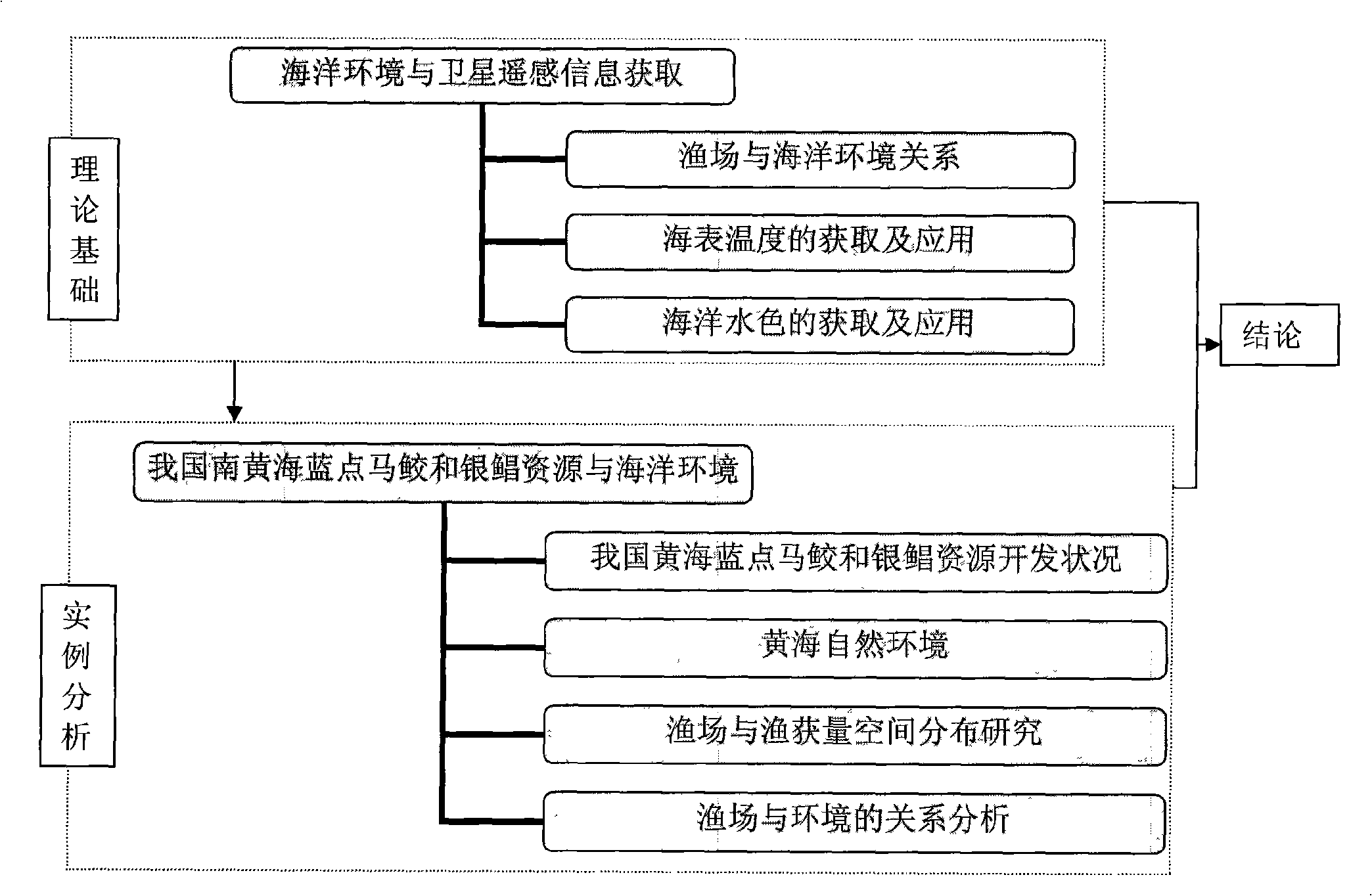
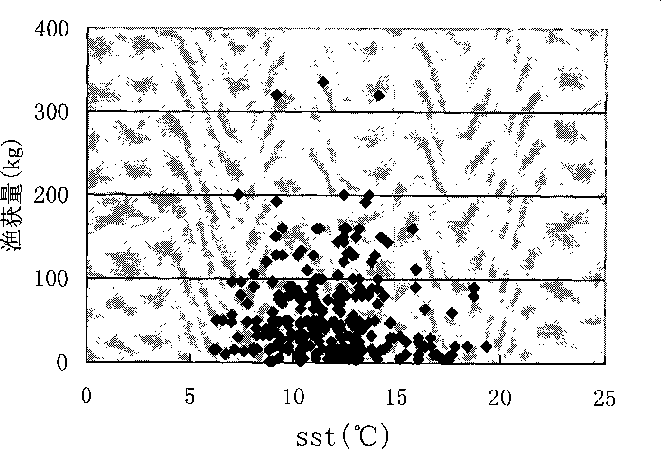
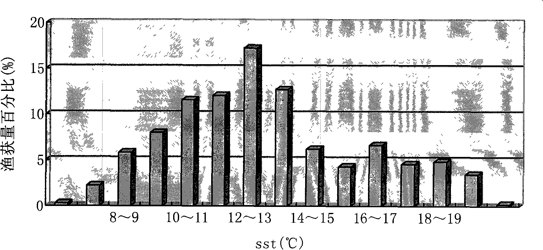
[0020] Through the sea surface temperature data provided by the satellite ground station and the satellite remote sensing chlorophyll data provided by NASA / GSFC / SeaWIFS, using MCSST and other algorithms and the spatial visualization method of remote sensing software Surfer contour analysis, combined with the natural environment characteristics of the Yellow Sea, the study was conducted in my country The horizontal distribution characteristics of sea surface temperature in the South Yellow Sea area from April to June 2006 and the spatial distribution and spatial changes of sea chlorophyll were investigated and studied on the distribution of catches of blue-spotted Spanish mackerel and silver pomfret in the South Yellow Sea in my country, and quantitative studies were conducted. Relationships between catches of blue-spotted Spanish mackerel and silver pomfret and elements of the marine environment.
PUM
 Abstract
Description
Claims
Application Information
 - R&D Engineer
- R&D Manager
- IP Professional
- Industry Leading Data Capabilities
- Powerful AI technology
- Patent DNA Extraction
Browse by: Latest US Patents, China's latest patents, Technical Efficacy Thesaurus, Application Domain, Technology Topic, Popular Technical Reports.
© 2024 PatSnap. All rights reserved.Legal|Privacy policy|Modern Slavery Act Transparency Statement|Sitemap|About US| Contact US: help@patsnap.com


