
System and method of indicating the distance or the surface of an image of a geographical object

a geographical object and distance technology, applied in the field of system and method of indicating the distance or the surface of an image of a geographical object, can solve the problem that the cursor itself does not convey information about the street level image itsel

Active Publication Date: 2016-10-25
GOOGLE LLC
View PDF9 Cites 73 Cited by
  • Summary
  • Abstract
  • Description
  • Claims
  • Application Information

AI Technical Summary

Benefits of technology

The patent describes a method and system for displaying images of geographical objects, such as buildings or trees, using an image from a camera and data about the position of the object relative to the camera. The system can process this data to determine the shape and size of the object and display it on a screen with a visual characteristic, such as an icon or a text label. This makes it easier for viewers to identify and understand the objects in the images.

Problems solved by technology

However, even though the cursor may be used to change or otherwise interact with the street level image, the cursor itself does not convey information about the street level image itself.

Method used


Image

  • System and method of indicating the distance or the surface of an image of a geographical object
  • System and method of indicating the distance or the surface of an image of a geographical object
  • System and method of indicating the distance or the surface of an image of a geographical object

Examples


Embodiment Construction

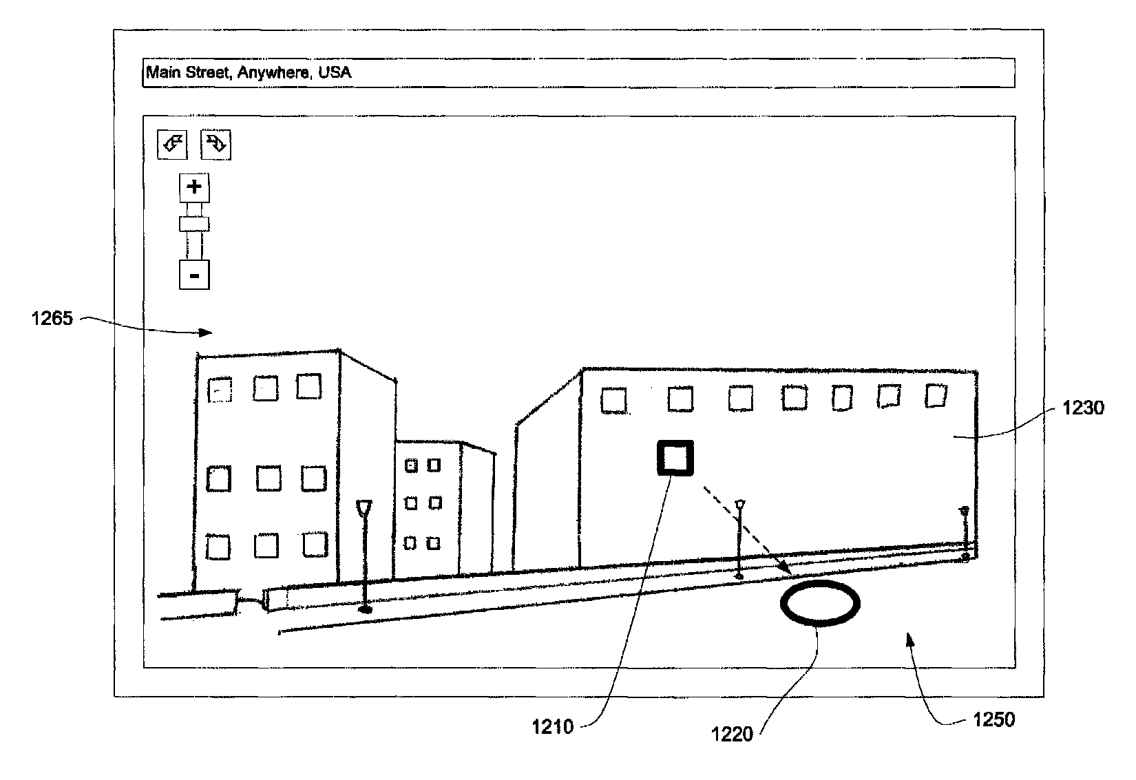
[0023]In one aspect, the system and method displays cursors for street level images, where the cursor appears to lie flat against the objects in the image and changes based on the user's manipulation of a mouse, keyboard or other navigation method. The size of the cursor also changes based on the distance of an object under the cursor to the camera position. This and other aspects are described below.

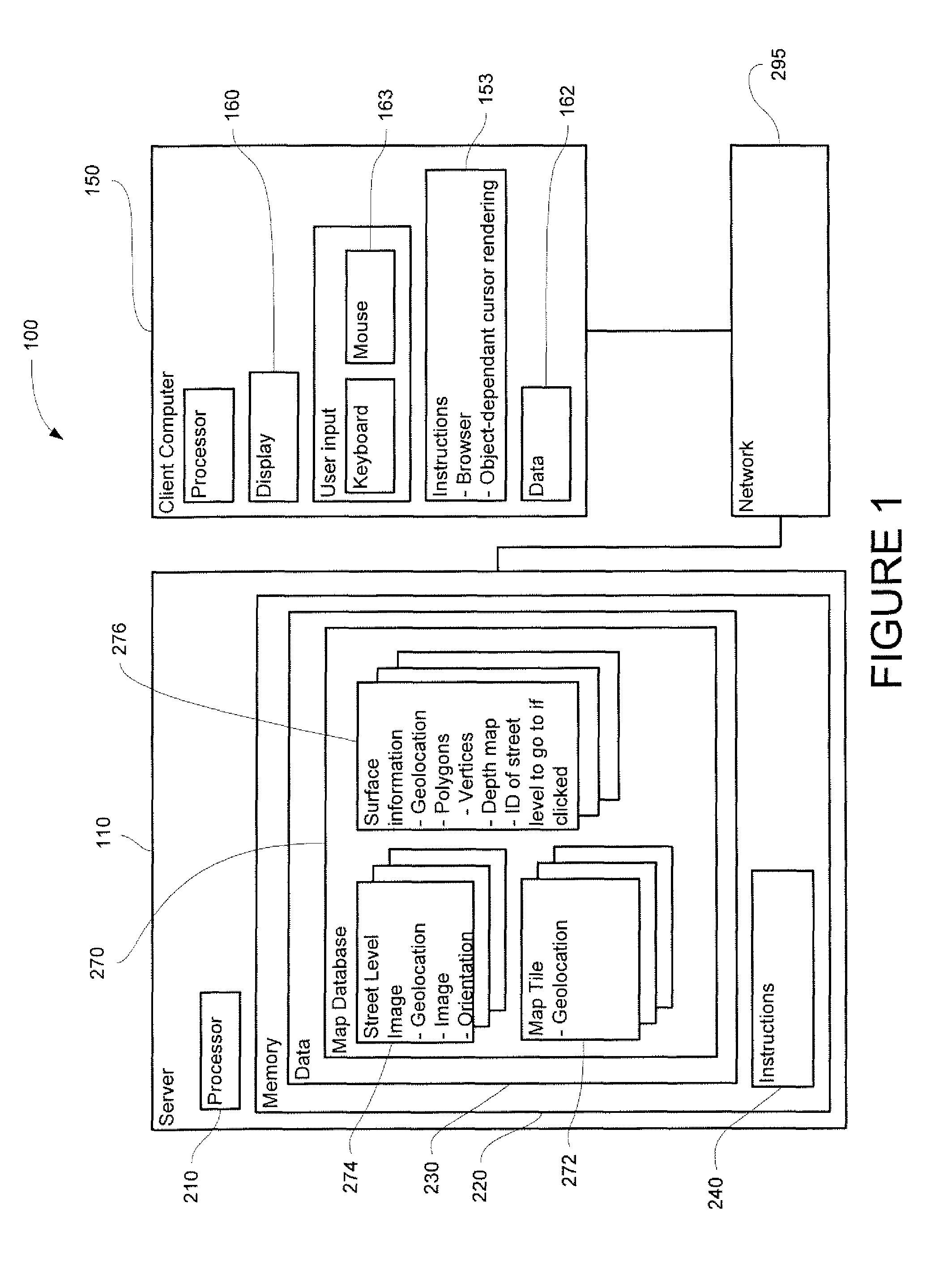
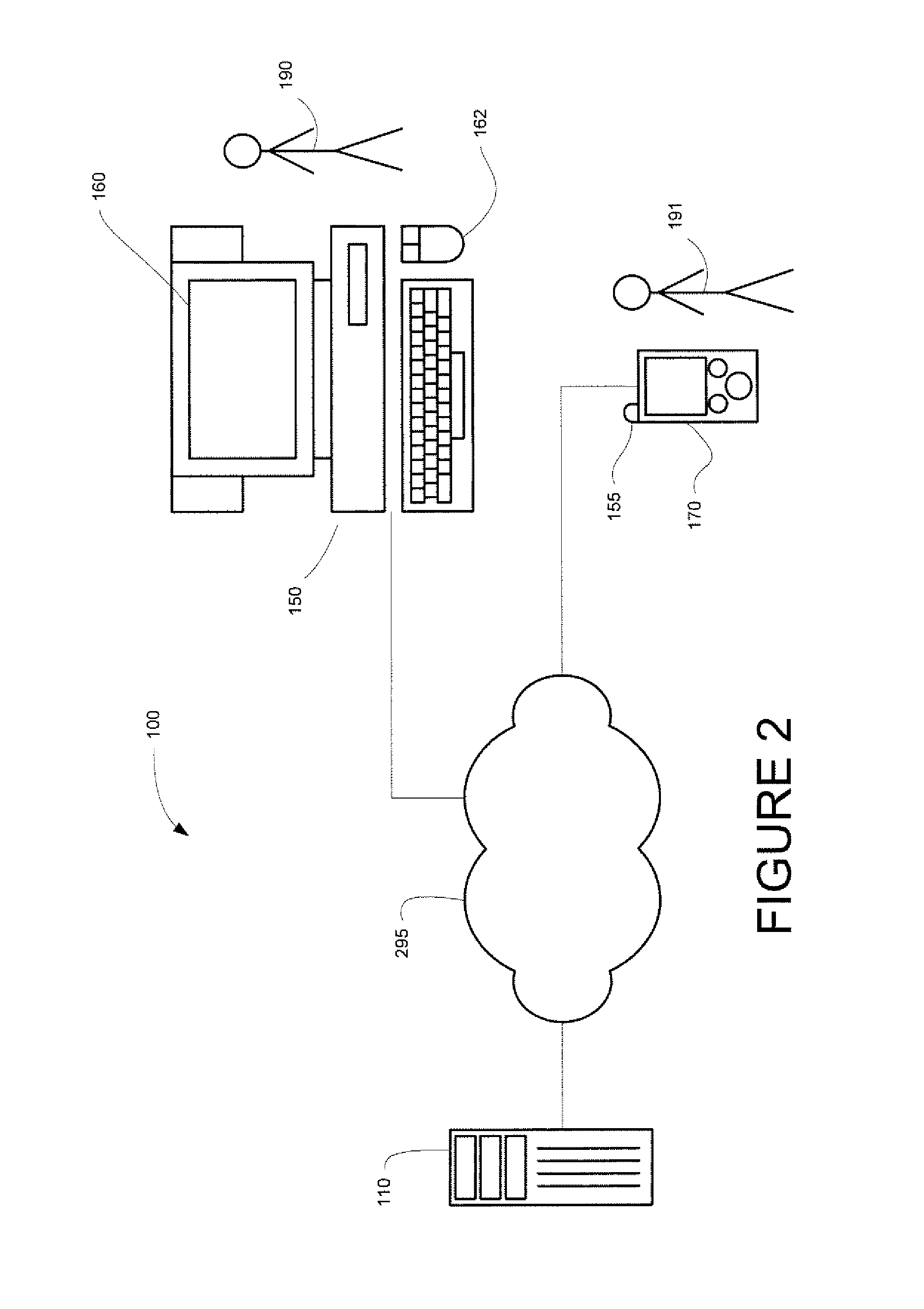
[0024]As shown in FIGS. 1-2, a system 100 in accordance with one aspect of the invention includes a computer 110 containing a processor 210, memory 220 and other components typically present in general purpose computers.

[0025]Memory 220 stores information accessible by processor 210, including instructions 240 that may be executed by the processor 210. It also includes data 230 that may be retrieved, manipulated or stored by the processor. The memory may be of any type capable of storing information accessible by the processor, such as a hard-drive, memory card, ROM, RAM, DVD, CD-ROM, w...


PUM


Abstract

A system and method is provided that displays cursors for street level images, where the cursor changes appearance based on the objects in the image, such as the geographic distance between the objects and the camera position and the surface of the objects. For example, the cursor may appear to lie flat against the objects in the image change size based on the distance between the camera and object's surface.

Description

BACKGROUND OF THE INVENTION[0001]Services such as Google Maps are capable of displaying street level images of geographic locations. These images, known on Google Maps as “Street View”, typically comprise photographs of buildings and other features, and allow a user to view a geographic location from a person's perspective as compared to a top-down map perspective.[0002]When displayed on a monitor, a user may interact with an image by manipulating a cursor and 3D objects displayed on the image. For example, Google Maps often draws a yellow line corresponding with a street on the image; the line is drawn as if it were painted on the street. When the user moves the cursor to an arrow on the yellow line, and clicks the arrow, the image may change to a nearby street level image taken from a different perspective or location. However, even though the cursor may be used to change or otherwise interact with the street level image, the cursor itself does not convey information about the str...

Claims


Application Information

Patent Timeline
Patent Type & Authority Patents(United States)
IPC IPC(8): G06F3/048
CPCG06F3/048G06F16/29G01C21/367G06F3/04812
Inventor FILIP, DANIELSZYBALSKI, ANDREW
Owner GOOGLE LLC
Learn More