
Displaying images in a network or visual mapping system

a visual mapping and network technology, applied in the direction of traffic control systems, navigation instruments, instruments, etc., can solve the problems of limited value of aerial or rooftop views, online maps do not provide images of physical surroundings associated with them, and do not provide listings

Active Publication Date: 2009-09-08
A9 COM INC
View PDF41 Cites 182 Cited by
  • Summary
  • Abstract
  • Description
  • Claims
  • Application Information

AI Technical Summary

Benefits of technology

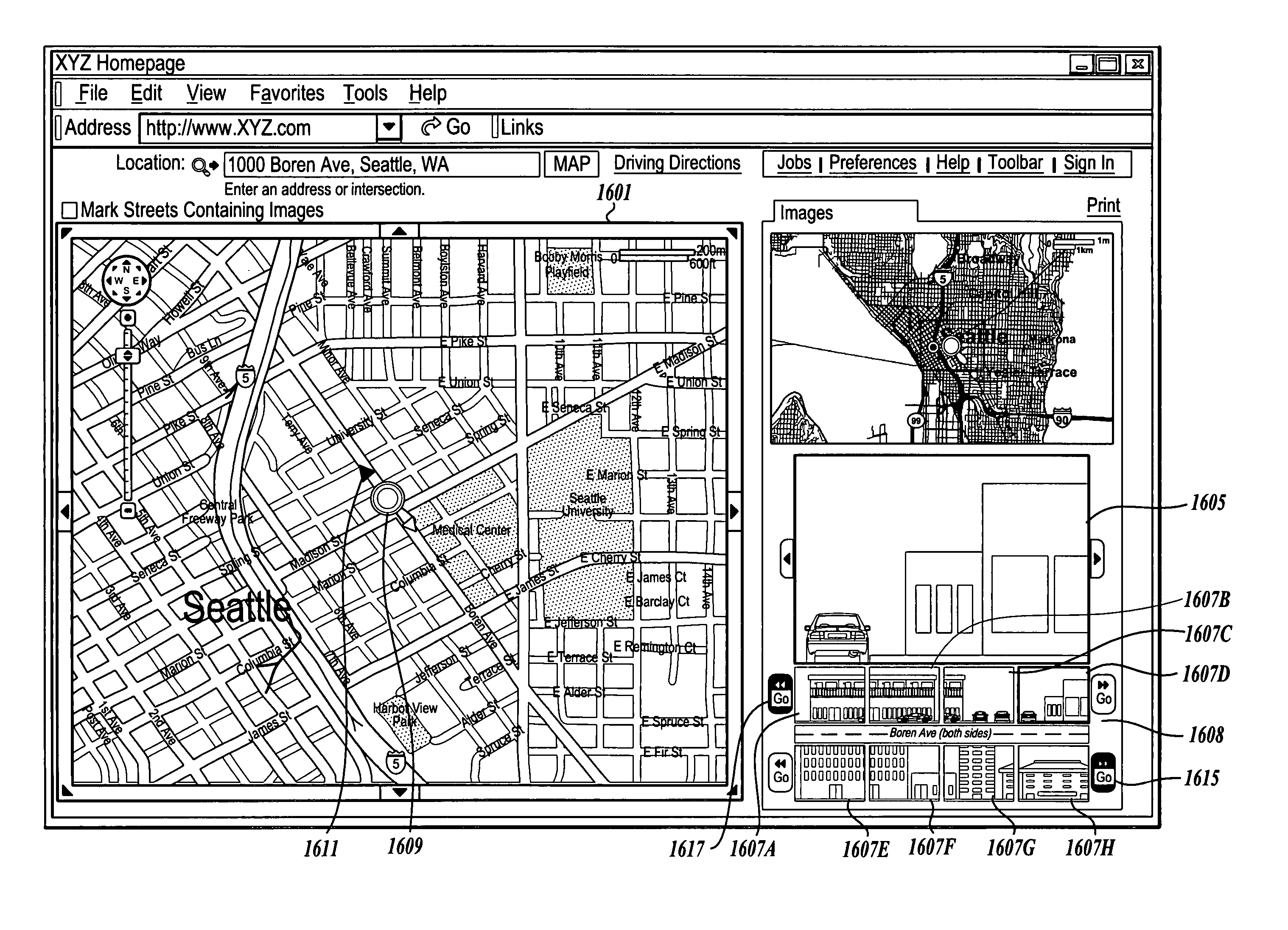
[0005]The present invention provides methods and systems whereby online maps, such as street maps, may be displayed along with images of building and other objects at physical locations represented by those maps. Thus, a user accessing an online map prepared using embodiments of the present invention can visually appreciate the businesses, buildings, streets, and also perhaps areas surrounding a location.
[0009]Accordingly, an online map system of the present invention permits the user to visually appreciate not only street maps and images of various locations within the street maps, but also images surrounding those locations. A user may also interact with the scroll icons to obtain new images thereby virtually moving up or down the street.

Problems solved by technology

Current online directories, however, do not provide listings that can be displayed with an image of the physical location of the business featured in the listing.
While some aerial or rooftop images are available online in correlation with addresses, such aerial or rooftop views are of limited value because they do not show, for example, business buildings in the manner actually perceived by customers (i.e., at the ground or street level).
Additionally, online maps do not provide images of physical surroundings associated with points on a map.
More particularly, what is lacking is an automated system and method for collecting and displaying images of objects at geographic locations, such as business storefronts and street views of structures, in online directories and maps.

Method used


Image

  • Displaying images in a network or visual mapping system
  • Displaying images in a network or visual mapping system
  • Displaying images in a network or visual mapping system

Examples


Embodiment Construction

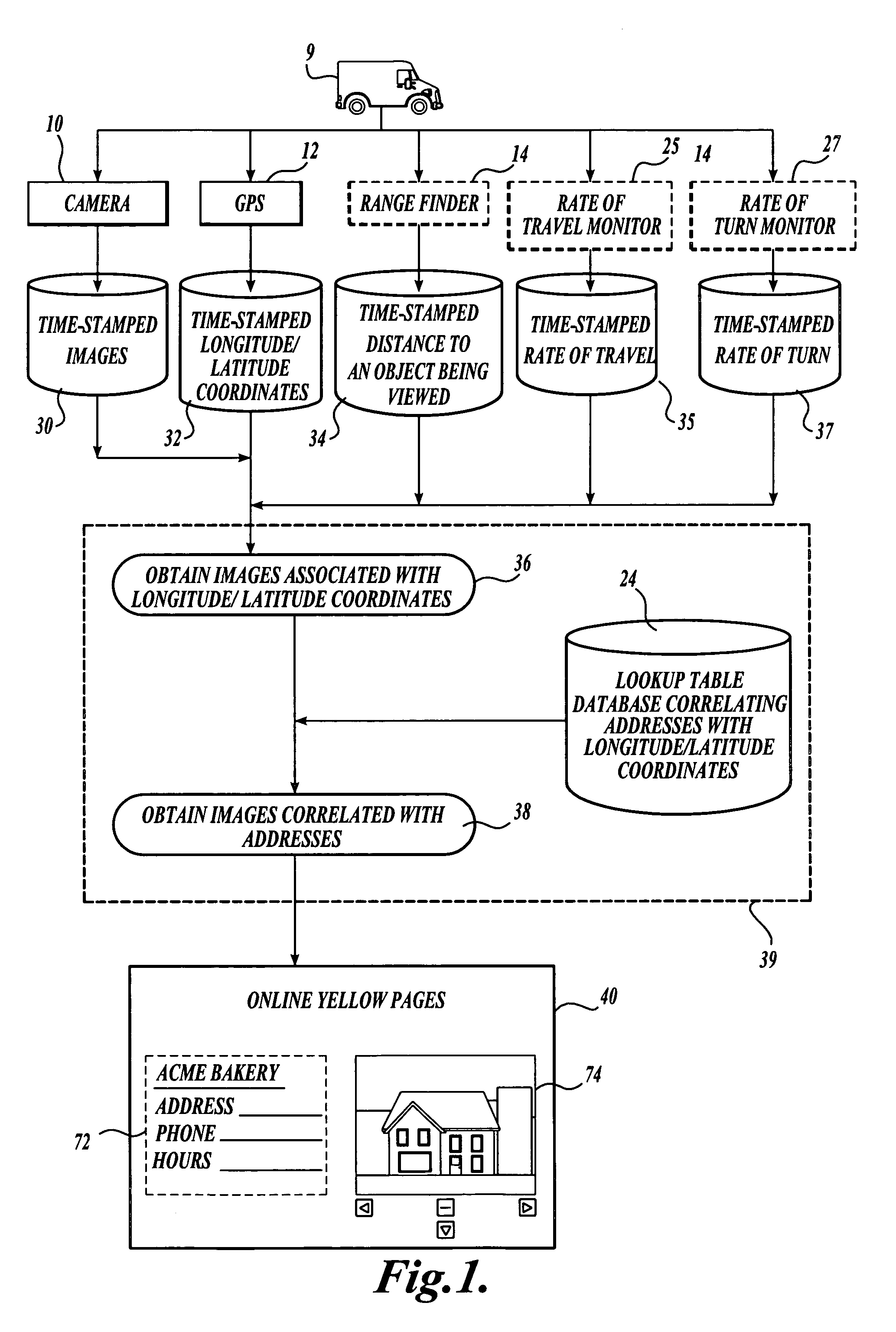
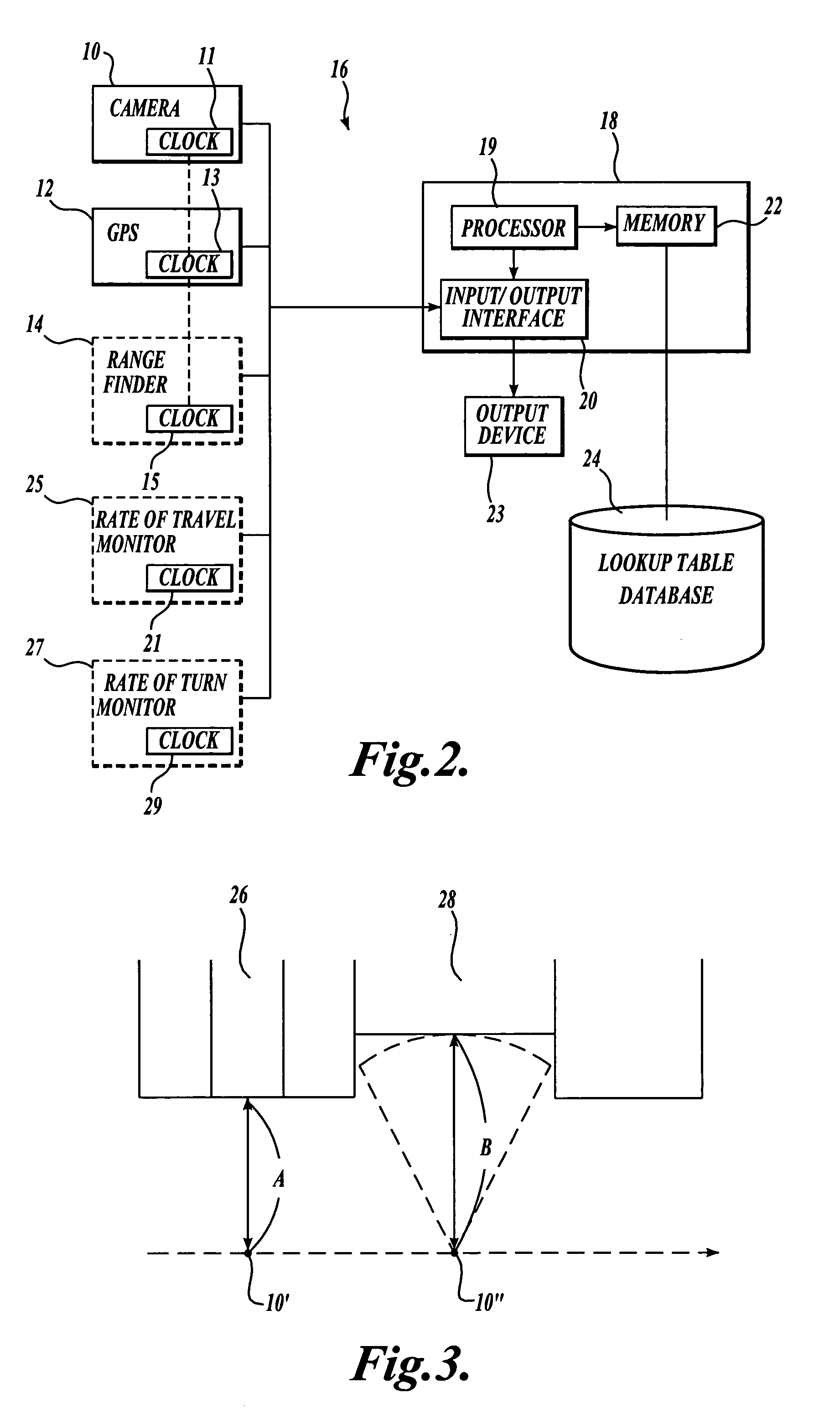
[0028]The present invention is directed to a system and method for collecting and displaying images of objects (including, without limitation, buildings, structures, and store fronts) obtained at different geographic locations. The images may be displayed in association with corresponding listings in online directories. The following detailed description provides several exemplary implementations of the invention. Although specific system configurations and flow diagrams are illustrated, it should be understood that the examples provided are not exhaustive and do not limit the invention to the precise forms disclosed. Persons having ordinary skill in the field of digital data processing will recognize that the computer components and arrangements described herein may be interchangeable with other components and arrangements and that the process steps described herein may be interchangeable with other steps or their combinations, and still achieve the benefits and advantages of the p...


PUM


Abstract

Embodiments of the present invention provide a method and system for generating a street map that includes a position identifier that identifies a location on the street map. The method and system may also generate and display a plurality of images representative of the location of the position identifier. A user may interact with a position identifier or one of several scroll icons to view images of other locations on the street map and / or to obtain driving directions between two locations.

Description

CROSS-REFERENCES TO RELATED APPLICATIONS[0001]This application is a continuation-in-part of U.S. patent application Ser. No. 11 / 045,007, filed Jan. 26, 2005, which is a continuation-in-part of U.S. patent application Ser. No. 10 / 809,049, filed Mar. 24, 2004, which are incorporated herein by reference.FIELD OF THE INVENTION[0002]The present invention is related to production of online directories and, more specifically, to online directories, such as Yellow Pages, at which a user can view images of directory listings.BACKGROUND OF THE INVENTION[0003]Various online directories and map services, such as online Yellow Pages and MapQuest®, are available for users to locate and find information about businesses and services and directions to those businesses. Typically, when searching an online business directory, a user is prompted to enter selection criteria, such as the general geographic location (e.g., state and city), and the type or category of business (e.g., restaurant) that the ...

Claims


Application Information

Patent Timeline
Patent Type & Authority Patents(United States)
IPC IPC(8): G01C21/26G01C21/32G06F3/048G08G1/137
CPCG01C21/26G06Q30/0256G09B29/12G06F17/3087G06Q10/083G06F16/9537G06F3/04842G06F3/0481G06F3/04817G06F3/04845G06F3/04847G06T3/0018G06T3/40G06T2200/24G01C21/367G01C21/3673G06F3/04812G06F3/0482G06F3/0485G06F2203/04806G06T3/4038
Inventor GOLD, JONATHAN ACARO-BRUCE, TIMOTHYHA, HUY THJELMSTAD, JOHN ALANVOLKERT, CHRISTOPHER AARON
Owner A9 COM INC
Learn More