
Geotagging using barcodes

a barcode and geotagging technology, applied in the field of geotagging, can solve the problems of poor performance in indoor locations and other limited-reception environments, gps-based geotagging information only provides location information without other useful effects

Inactive Publication Date: 2011-04-07
SAMSUNG ELECTRONICS CO LTD
View PDF7 Cites 70 Cited by
  • Summary
  • Abstract
  • Description
  • Claims
  • Application Information

AI Technical Summary

Problems solved by technology

GPS-based geotagging suffers from various drawbacks, including poor performance in indoor locations and other limited-reception environments, such as an urban canyon.
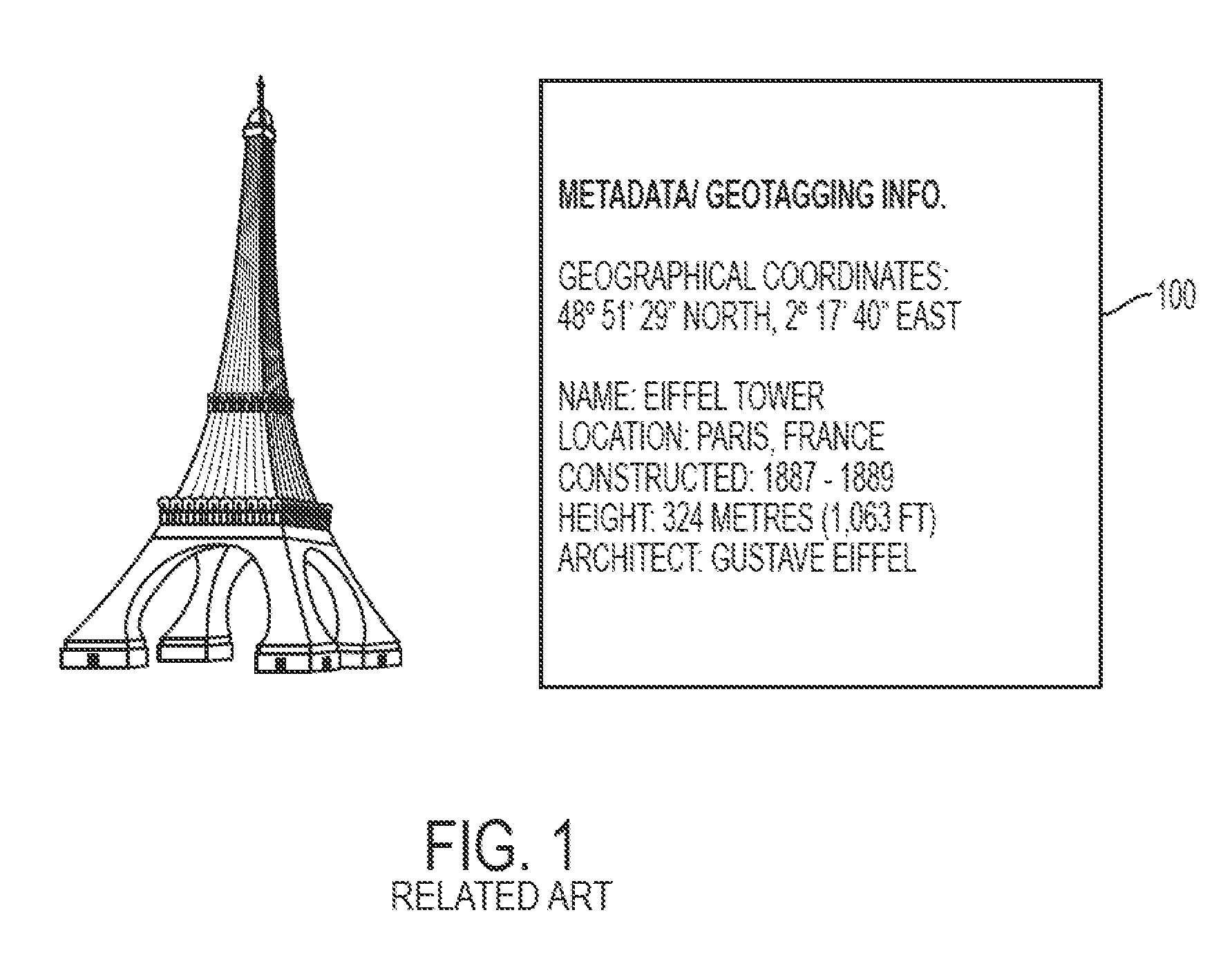
Moreover, GPS-based geotagging information only provides location information without other useful details, such as place name and the like.
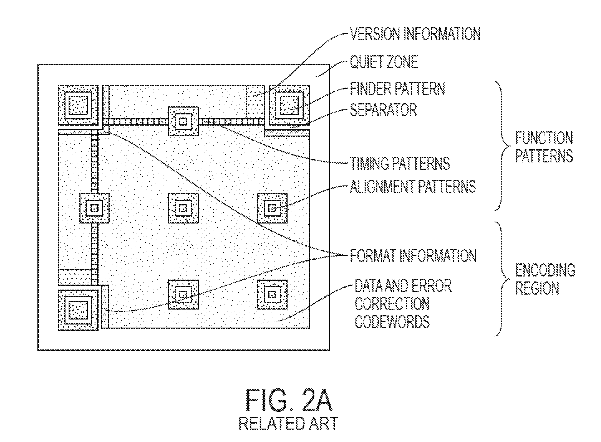
The conventional barcodes get wider as more data is encoded, and eventually become too wide to be useful.

Method used


Image

  • Geotagging using barcodes
  • Geotagging using barcodes
  • Geotagging using barcodes

Examples


Embodiment Construction

[0034]The following description with reference to the accompanying drawings is provided to assist in a comprehensive understanding of exemplary embodiments of the invention as defined by the claims and their equivalents. It includes various specific details to assist in that understanding but these are to be regarded as merely exemplary. Accordingly, those of ordinary skill in the art will recognize that various changes and modifications of the embodiments described herein can be made without departing from the scope and spirit of the invention. In addition, descriptions of well-known functions and constructions are omitted for clarity and conciseness.

[0035]The terms and words used in the following description and claims are not limited to the bibliographical meanings, but are merely used by the inventor to enable a clear and consistent understanding of the invention. Accordingly, it should be apparent to those skilled in the art that the following description of exemplary embodimen...


PUM


Abstract

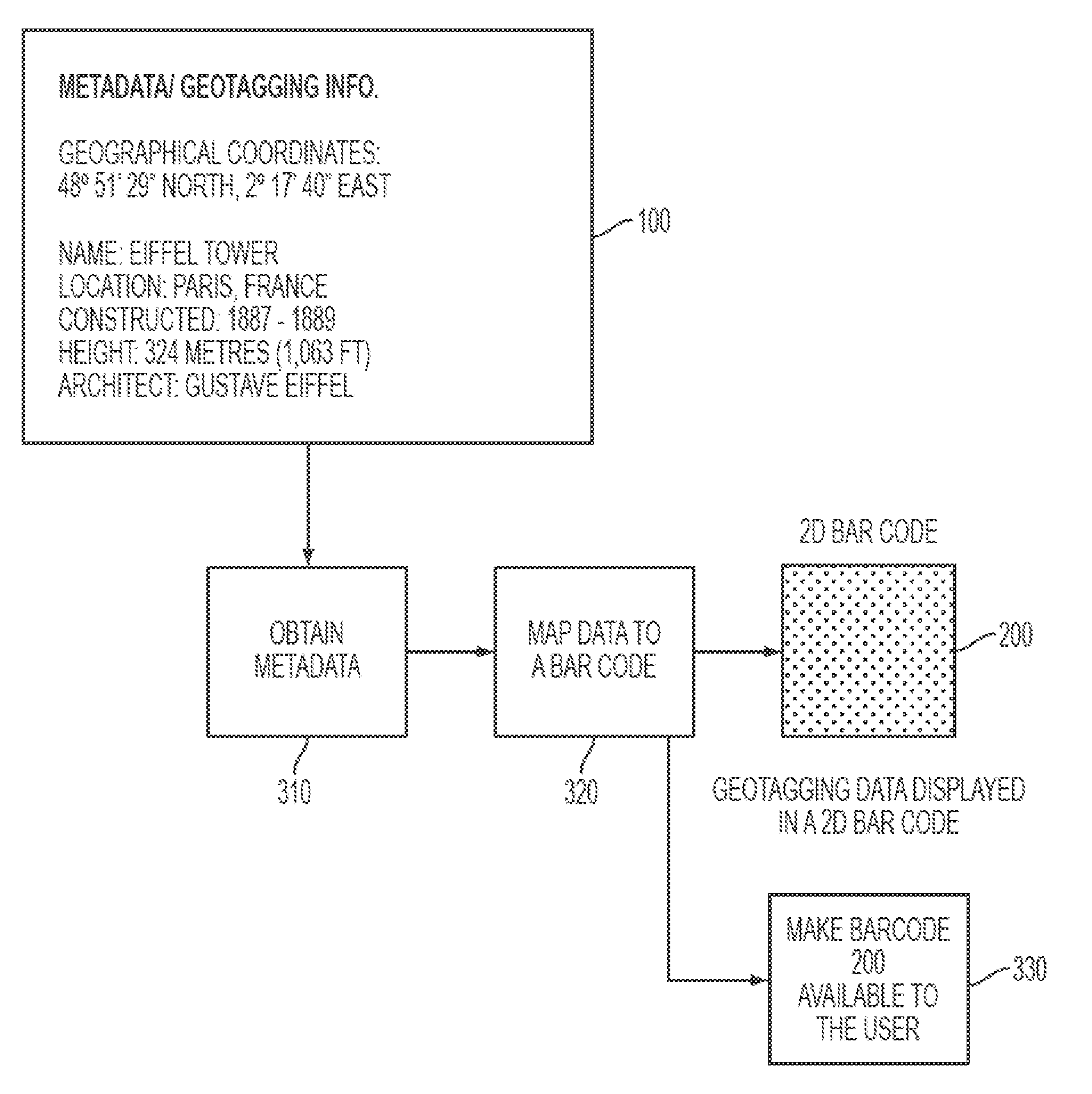
A method and apparatus for associating geotag information obtained from a barcode with image or video data is provided. The apparatus includes a camera module for capturing an image or video of an object, a barcode decoding module for receiving barcode data related to the object and for extracting geotag information from the barcode data, and a processor for associating the geotag information with the image or video.

Description

CROSS-REFERENCE TO RELATED APPLICATIONS[0001]This application claims the benefit under 35 U.S.C. §119(e) of a U.S. Provisional application filed on Oct. 6, 2009 in the U.S. Patent and Trademark Office and assigned Ser. No. 61 / 249,183, the entire disclosure of which is hereby incorporated by reference.BACKGROUND OF THE INVENTION[0002]1. Field of the Invention[0003]Aspects of the present invention relate to geotagging. More particularly, aspects of the present invention relate to creating barcodes based on geotags and reading barcodes corresponding to geotags.[0004]2. Description of the Related Art[0005]Geotagging is a process of adding geographical identification metadata to various media, such as photographs, video, websites, or RSS (most commonly translated as “Really Simple Syndication”) feeds. A geotag is a form of geospatial metadata usually including latitude and longitude coordinates, though they can also include altitude, bearing, accuracy data, place names, and other identif...

Claims


Application Information

Patent Timeline
IPC IPC(8): G06F17/00G06K7/10G06K19/06G06F13/00
CPCH04N1/00326H04N2201/3253H04N2201/0084H04N1/00334
Inventor KHAN, FAROOQ
Owner SAMSUNG ELECTRONICS CO LTD
Learn More